Fru Annes Sten
Fru Annes Sten is a stone in Norddjurs Municipality, Central Jutland. Fru Annes Sten is situated nearby to the manor estate Hessel, as well as near Djurslands Rideklub.| Tap on a place to explore it |
Places of Interest Nearby
Highlights include Hessel railway station and Ålsø Church.
Hessel railway station
Railway stop
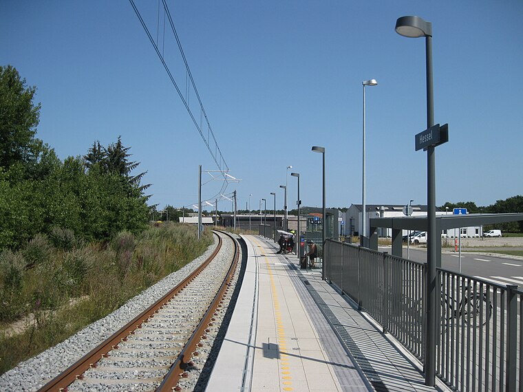
Photo: Alicudi, CC BY-SA 4.0.
Hessel station is a railway station serving the southern part of the town and seapor of Grenaa on the Djursland peninsula in East Jutland, Denmark. The station is located on the Grenaa Line between Aarhus and Grenaa. Hessel railway station is situated 1 km north of Fru Annes Sten.
Ålsø Church
Church

Photo: Bococo, CC BY-SA 3.0.
Ålsø Church is situated 2 km southwest of Fru Annes Sten.
Katholm Castle
Castle

Photo: Wikimedia, CC BY-SA 3.0.
Katholm Castle is a manor house located on the Djursland peninsula, six km south of Grenaa, in eastern Denmark. Built in the Renaissance style from 1588 to 1591 and expanded in 1622, it is set on a castle bank in the middle of an artificial lake in a forested area. Katholm Castle is situated 2½ km south of Fru Annes Sten.
Places in the Area
Nearby places include Grenå and Trustrup.
Grenå

Photo: Old Dane, CC BY-SA 4.0.
Grenaa is a Danish town and seaport on the east coast of the Jutland peninsula. Tourism, education and commerce are important sectors in the economy of Grenaa.
Trustrup
Village
Photo: Sapfan, Public domain.
Trustrup is a small railway town, with a population of 776, in Norddjurs Municipality, Central Denmark Region in Denmark. It is located 21 km east of Ryomgård, 21 km north of Ebeltoft and 13 km southwest of the municipal seat Grenaa. Trustrup is situated 7 km southwest of Fru Annes Sten.
Lyngby
Hamlet

Photo: Bococo, CC BY-SA 3.0.
Lyngby is a small village with a population of 300, located in Norddjurs Municipality, Central Denmark Region in Denmark. Lyngby Church is situated within the village. Lyngby is situated 8 km west of Fru Annes Sten.
Fru Annes Sten
- Type: Stone
- Category: landform
- Location: Norddjurs Municipality, Central Jutland, Denmark, Nordic countries, Europe
- View on OpenStreetMap
Latitude
56.38173° or 56° 22′ 54″ northLongitude
10.87707° or 10° 52′ 37″ eastOpen location code
9F8G9VJG+MROpenStreetMap ID
node 9318896057OpenStreetMap feature
natural=stone
This page is based on OpenStreetMap, Wikidata, and Wikimedia Commons.
We’d love your help improving our open data sources. Thank you for contributing.
Satellite Map
Discover Fru Annes Sten from above in high-definition satellite imagery.
Notable Places Nearby
Highlights include Hessel and Djurslands Rideklub.
Nearby Places
Explore places such as Grenaa - Høbjergvej/Århusvej and Wash World.
Denmark: Must-Visit Destinations
Delve into Copenhagen, Aarhus, Odense, and Aalborg.
Curious Stones to Discover
Uncover intriguing stones from every corner of the globe.
About Mapcarta. Data © OpenStreetMap contributors and available under the Open Database License". Text is available under the CC BY-SA 4.0 license, except for photos, directions, and the map. Photo: Wikimedia, CC BY-SA 3.0.