IG Metall Mülheim
IG Metall Mülheim is an office in Mülheim, Mülheim an der Ruhr, North Rhine-Westphalia which is located on Friedrichstraße. IG Metall Mülheim is situated nearby to the community center together mülheim, as well as near the hospital Evangelisches Krankenhaus Mülheim.| Tap on a place to explore it |
- Opening hours:
Monday: 10:00 AM—noon and 1:00 PM—4:00 PM
Tuesday and Thursday: 9:00 AM—noon and 1:00 PM—4:00 PM
Wednesday and Friday: 9:00 AM—noon
public holidays: closed - Email: meo@igmetall.de
- Type: Office
- Also known as: “IGM MOE”, “IGM Mülheim-Essen-Oberhausen”, and “Industriegewerkschaft Metall”
- Address: 2, Friedrichstraße 24, Mülheim an der Ruhr, 45468
- Wheelchair access: no
Places of Interest Nearby
Highlights include Evangelisches Krankenhaus Mülheim and Broich Castle.
Evangelisches Krankenhaus Mülheim
Hospital
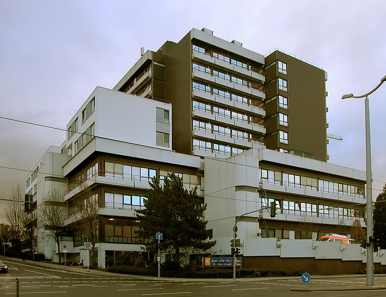
Photo: Ruesterstaude, CC BY-SA 3.0.
Evangelisches Krankenhaus Mülheim is a hospital, which is situated 140 metres east of IG Metall Mülheim.
Broich Castle

Photo: Wikimedia, Public domain.
Broich Castle is situated 730 metres northwest of IG Metall Mülheim.
Freilichtbühne Mülheim an der Ruhr
Theater building

Photo: Wikimedia, CC BY-SA 2.5.
The Freilichtbühne Mülheim an der Ruhr is an open-air amphitheatre in North Rhine-Westphalia, Germany, built in 1936 as a Nazi Thingplatz. It is the most important open-air theatre in the Rhine-Ruhr region and with 2,000 seats, one of the largest in Germany. Freilichtbühne Mülheim an der Ruhr is situated 390 metres southeast of IG Metall Mülheim.
Places in the Area
Nearby places include Siedlung Mausegatt and Styrum.
Siedlung Mausegatt
Neighborhood

Photo: Mdarge, CC BY-SA 3.0.
Siedlung Mausegatt is a neighborhood, which is situated 3 km east of IG Metall Mülheim.
Styrum
Suburb

Photo: Docfeelgood3, Public domain.
Styrum is a suburb, which is situated 3½ km northwest of IG Metall Mülheim.
Alstaden
Suburb

Photo: Macchiavelli2, CC BY-SA 4.0.
Alstaden is a suburb, which is situated 5 km northwest of IG Metall Mülheim.
IG Metall Mülheim
Latitude
51.42449° or 51° 25′ 28″ northLongitude
6.88121° or 6° 52′ 52″ eastBrand
IG MetallOpen location code
9F38CVFJ+QFOpenStreetMap ID
node 9353208147OpenStreetMap feature
office=unionOpenStreetMap attribute
wheelchair=no
This page is based on OpenStreetMap, Wikidata, and Wikimedia Commons.
We’d love your help improving our open data sources. Thank you for contributing.
Satellite Map
Discover IG Metall Mülheim from above in high-definition satellite imagery.
Notable Places Nearby
Highlights include together mülheim and Café Ziegler.
Nearby Places
Explore places such as Gewerkschaftshaus and Martin Kottmann.
Ruhr: Must-Visit Destinations
Delve into Dortmund, Essen, Duisburg, and Gelsenkirchen.
Curious Offices to Discover
Uncover intriguing offices from every corner of the globe.
About Mapcarta. Data © OpenStreetMap contributors and available under the Open Database License". Text is available under the CC BY-SA 4.0 license, except for photos, directions, and the map. Photo: Omi´s Törtchen, CC BY-SA 2.0 de.