Gan. Heinr.-Schwarz-Weg 40
Gan. Heinr.-Schwarz-Weg 40 is an electrical substation in Ganderkesee, Oldenburg, Lower Saxony. Gan. Heinr.-Schwarz-Weg 40 is situated nearby to the archaeological site Großsteingrab Steinkimmen 3, as well as near Megalithic stones of Steinkimmen.| Tap on a place to explore it |
Places of Interest Nearby
Highlights include Megalithic stones of Steinkimmen and Falkensteinsee.
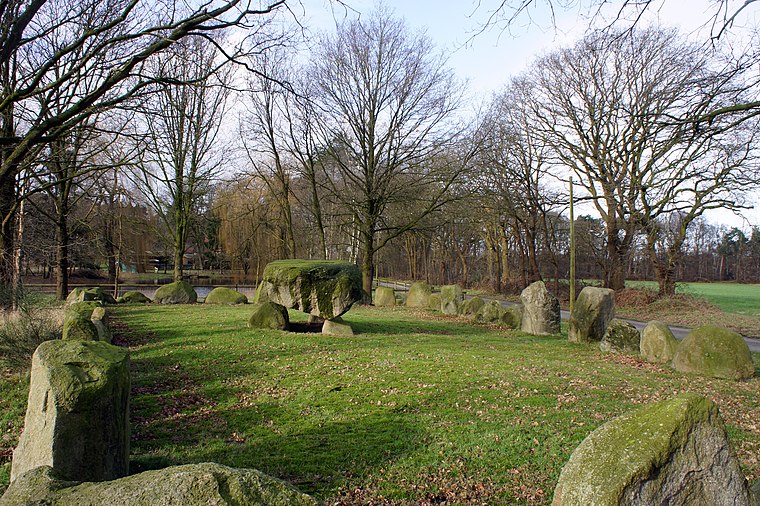
Megalithic stones of Steinkimmen
Archaeological site

Photo: Ralf Krebs, CC BY 3.0.
Megalithic stones of Steinkimmen is an archaeological site, which is situated 640 metres north of Gan. Heinr.-Schwarz-Weg 40.

Heidenwall (Dehlthun)
Archaeological site

Photo: Billboa, CC BY-SA 3.0.
Heidenwall (Dehlthun) is an archaeological site, which is situated 3 km southeast of Gan. Heinr.-Schwarz-Weg 40.
Places in the Area
Nearby places include Steinkimmen and Bergedorf.


Gan. Heinr.-Schwarz-Weg 40
- Type: Electrical substation
- Category: industry
- Location: Ganderkesee, Oldenburg, Lower Saxony, Germany, Central Europe, Europe
- View on OpenStreetMap
Latitude
53.03963° or 53° 2′ 23″ northLongitude
8.45388° or 8° 27′ 14″ eastOperator
EWE NetzOpen location code
9F5C2FQ3+VHOpenStreetMap ID
node 9370114226OpenStreetMap feature
man_made=street_cabinet
This page is based on OpenStreetMap, Wikidata, and Wikimedia Commons.
We’d love your help improving our open data sources. Thank you for contributing.
Satellite Map
Discover Gan. Heinr.-Schwarz-Weg 40 from above in high-definition satellite imagery.
Notable Places Nearby
Highlights include Großsteingrab Steinkimmen 3 and Großsteingrab Steinkimmen 1.
Nearby Places
Explore places such as Fernsehturm and Gemüsehof Bruns.
Lower Saxony: Must-Visit Destinations
Delve into Hanover, Göttingen, Brunswick, and Wolfsburg.
Curious Electrical Substations to Discover
Uncover intriguing electrical substations from every corner of the globe.
About Mapcarta. Data © OpenStreetMap contributors and available under the Open Database License". Text is available under the CC BY-SA 4.0 license, except for photos, directions, and the map. Photo: Danapit, CC BY-SA 3.0.