EZ Way
EZ Way is a convenience store in Saint Matthews Township, Wake, North Carolina which is located on Plainview Drive. EZ Way is situated nearby to Hillcrest Church, as well as near Church in Raleigh.| Tap on a place to explore it |
Places of Interest Nearby
Highlights include Raleigh Christian Academy and St. Augustine’s University.
Raleigh Christian Academy
School
 Raleigh Christian Academy is a private, Christian, coeducational, primary and secondary day school located in Raleigh, North Carolina, United States. Also referred to as simply Raleigh Christian, the school seeks to educate students in a traditional Christian environment. Raleigh Christian Academy is situated 4,100 feet north of EZ Way.
St. Augustine’s University
University

Photo: Mx. Granger, CC0.
Saint Augustine's University is a private historically black Christian college in Raleigh, North Carolina. It was founded by Episcopal Church clergy in 1867 for the education of formerly enslaved Black people. St. Augustine’s University is situated 2½ miles west of EZ Way.
Enloe High School
School
William G. Enloe GT/IB Magnet Center for the Humanities, Sciences and the Arts, also known as Enloe Magnet High School or Enloe High School, is a public magnet high school offering Gifted & Talented and International Baccalaureate programs located in eastern Raleigh, North Carolina, United States. Enloe High School is situated 2 miles southwest of EZ Way.
Places in the Area
Nearby places include Historic Oakwood and Raleigh.
Historic Oakwood
Neighborhood
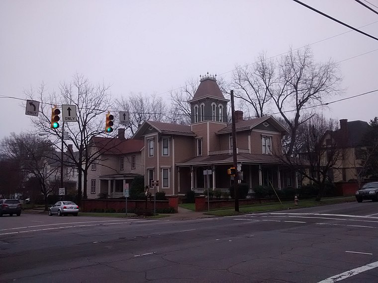
Photo: Mx. Granger, CC0.
Historic Oakwood is a neighborhood in downtown Raleigh, North Carolina, United States, on the National Register of Historic Places, that is known for its Historic Oakwood Cemetery and many Victorian and Second Empire houses. Historic Oakwood is situated 3 miles west of EZ Way.
Raleigh

Photo: Jmalljmall, Public domain.
The capital of North Carolina and the largest city of the Research Triangle, Raleigh is the primary political and economic driver of the metro area. Indeed, business and politics are the main draws to Raleigh, which lacks the more trendy feel or active arts scene of Durham or Chapel Hill to the west.
Millbrook
Suburb
Millbrook was a village in Wake County, North Carolina. Growth of Raleigh suburbs in the mid to late twentieth century swallowed up the village. Millbrook High, Middle, and Elementary school in Raleigh are named after the village. Millbrook is situated 4 miles northwest of EZ Way.
EZ Way
- Type: Convenience store
- Address: 1213 Plainview Drive, Raleigh, NC 27610
- Categories: shop and food
- Location: Saint Matthews Township, Wake, North Carolina, South, United States, North America
- View on OpenStreetMap
Latitude
35.79733° or 35° 47′ 50″ northLongitude
-78.57661° or 78° 34′ 36″ westOpen location code
8773QCWF+W9OpenStreetMap ID
node 9395638206OpenStreetMap feature
shop=convenience
This page is based on OpenStreetMap, Wikidata, and Wikimedia Commons.
We’d love your help improving our open data sources. Thank you for contributing.
Satellite Map
Discover EZ Way from above in high-definition satellite imagery.
Places with the Same Name
Discover other places named “EZ Way”.
Notable Places Nearby
Highlights include Hillcrest Church and Church in Raleigh.
Nearby Places
Explore places such as Exxon and New Bern Ave at Trawick Rd (EB).
North Carolina: Must-Visit Destinations
Delve into Charlotte, Raleigh, Asheville, and Greensboro.
Curious Convenience Stores to Discover
Uncover intriguing convenience stores from every corner of the globe.
About Mapcarta. Data © OpenStreetMap contributors and available under the Open Database License". Text is available under the CC BY-SA 4.0 license, except for photos, directions, and the map. Photo: southernfoodwaysalliance, CC BY 2.0.