Mont Saint-Vaast
Mont Saint-Vaast is a peak in Anzin-Saint-Aubin, Arrondissement of Arras, Hauts-de-France and has an elevation of 87 metres. Mont Saint-Vaast is situated nearby to the village Anzin-Saint-Aubin, as well as near the hamlet Louez.| Tap on a place to explore it |
Places of Interest
Highlights include Musée des beaux-arts d’Arras and Golf d’Arras.
Musée des beaux-arts d’Arras
Museum
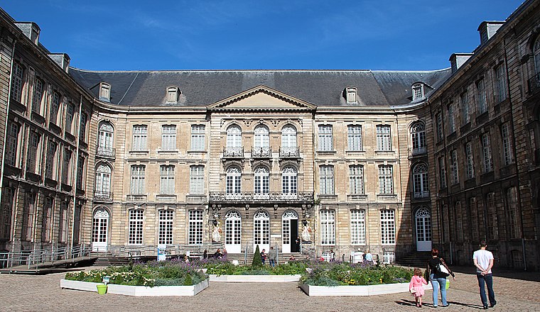
Photo: Jean-Pol GRANDMONT, CC BY 4.0.
The Musée des Beaux-Arts d'Arras is located in the old Abbey of St. Vaast in Arras, in the Nord-Pas-de-Calais, France.

Arras Cathedral
Church

Photo: Jean-Pol GRANDMONT, CC BY 4.0.
Arras Cathedral is the Catholic church in the city of Arras, France. The cathedral is the seat of the Bishops of Arras.
Places in the Area
Nearby places include Arras.
Arras

Photo: Mélanie Huguet, CC BY-SA 3.0.
Arras is an attractive town in the Hauts-de-France region of France. It was much fought-over in World War I and is mainly visited by tourists travelling from or to the nearby ports of Calais and Boulogne.
Mont Saint-Vaast
- Type: Peak with an elevation of 87 metres
- Category: landform
- Location: Anzin-Saint-Aubin, Arrondissement of Arras, Pas-de-Calais, Hauts-de-France, France, Europe
- View on OpenStreetMap
Latitude
50.3064° or 50° 18′ 23″ northLongitude
2.7323° or 2° 43′ 56″ eastElevation
87 metres (285 feet)Open location code
9F248P4J+GWOpenStreetMap ID
node 9428142499OpenStreetMap feature
natural=peak
This page is based on OpenStreetMap, Wikidata, and Wikimedia Commons.
We’d love your help improving our open data sources. Thank you for contributing.
Satellite Map
Discover Mont Saint-Vaast from above in high-definition satellite imagery.
Localities in the Area
Explore places such as Anzin-Saint-Aubin and Louez.
Notable Places Nearby
Highlights include LS Fitness and Hôpital privé Arras Les Bonnettes.
Hauts-de-France: Must-Visit Destinations
Delve into Lille, Dunkirk, Calais, and Amiens.
Curious Peaks to Discover
Uncover intriguing peaks from every corner of the globe.
About Mapcarta. Data © OpenStreetMap contributors and available under the Open Database License". Text is available under the CC BY-SA 4.0 license, except for photos, directions, and the map. Photo: Tony62, CC BY-SA 3.0.