Hidrološka postaja Okroglo
Hidrološka postaja Okroglo is a monitoring station in Naklo, Slovenia. Hidrološka postaja Okroglo is situated nearby to the church Cerkev sv. Marije Magdalene, as well as near the athletics track Pumptrack Vogu.| Tap on a place to explore it |
Places of Interest Nearby
Highlights include Mount Saint Margaret and Castle Khislstein.

Castle Khislstein
Castle
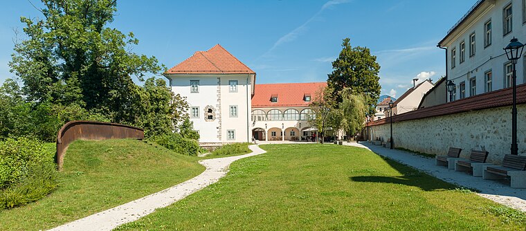
Photo: Meho29, CC BY-SA 4.0.
Kieselstein Castle, also known as Khislstein, is a 13th-century castle in the city of Kranj, in the Upper Carniola region of Slovenia. The castle stands at what was once a defensible point, guarding the city pier and crossing over the river Sava, and was predated on the site by a round 11th-century keep. Castle Khislstein is situated 3½ km southeast of Hidrološka postaja Okroglo.
Bauhenk
Sports venue

Photo: Meho29, CC BY-SA 3.0.
Bauhenk is a sports venue, which is situated 2 km southeast of Hidrološka postaja Okroglo.
Places in the Area
Nearby places include Okroglo and Rakovica.
Okroglo
Village

Photo: Doremo, CC BY-SA 4.0.
Okroglo is a settlement in the Municipality of Naklo in the Upper Carniola region of Slovenia.
Rakovica
Hamlet
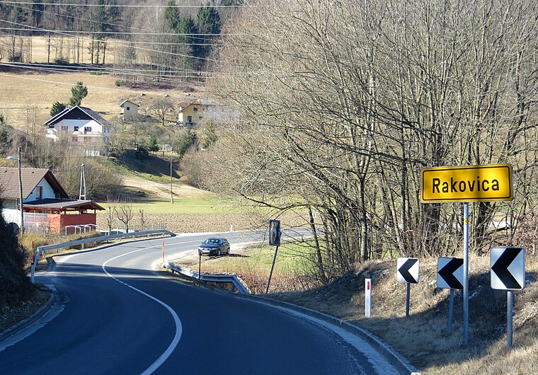
Photo: Doremo, CC BY-SA 4.0.
Rakovica is a settlement on the right bank of the Sava River northwest of Kranj in the Upper Carniola region of Slovenia.
Zabukovje
Hamlet

Photo: Mravlja Matjaz, CC BY-SA 4.0.
Zabukovje is a dispersed settlement below Sveti Jošt in the Municipality of Kranj in the Upper Carniola region of Slovenia.
Hidrološka postaja Okroglo
- Type: Monitoring station
- Location: Naklo, Slovenia, Central Europe, Europe
- View on OpenStreetMap
Latitude
46.25587° or 46° 15′ 21″ northLongitude
14.31961° or 14° 19′ 11″ eastOperator
Slovenian Environment AgencyOpen location code
8FRP7849+8ROpenStreetMap ID
node 9462917783OpenStreetMap feature
man_made=monitoring_station
This page is based on OpenStreetMap, Wikidata, and Wikimedia Commons.
We’d love your help improving our open data sources. Thank you for contributing.
Satellite Map
Discover Hidrološka postaja Okroglo from above in high-definition satellite imagery.
Notable Places Nearby
Highlights include Cerkev sv. Marije Magdalene and Pumptrack Vogu.
Nearby Places
Explore places such as Zveza društev slepih in Slabovidnih Slovenije and Center slepih in slabovidnih Naklo.
Slovenia: Must-Visit Destinations
Delve into Ljubljana, Maribor, Koper, and Celje.
Curious Monitoring Stations to Discover
Uncover intriguing monitoring stations from every corner of the globe.
About Mapcarta. Data © OpenStreetMap contributors and available under the Open Database License". Text is available under the CC BY-SA 4.0 license, except for photos, directions, and the map. Photo: Jjtkk, CC BY 3.0.