Christ Crucified
Christ Crucified is a work of art in Washington, D.C., Mid-Atlantic. Christ Crucified is situated nearby to Rosary Walk & Garden, as well as near the church Basilica of the National Shrine of the Immaculate Conception.| Tap on a place to explore it |
Places of Interest Nearby
Highlights include Basilica of the National Shrine of the Immaculate Conception and Saint John Paul II National Shrine.
Basilica of the National Shrine of the Immaculate Conception
Church

Photo: AgnosticPreachersKid, CC BY-SA 3.0.
The Basilica of the National Shrine of the Immaculate Conception is a Catholic minor basilica and national shrine in Washington D.C. It is the largest Catholic church building in North America and is also the tallest habitable building in Washington, D.C. Basilica of the National Shrine of the Immaculate Conception is situated 550 feet northeast of Christ Crucified.
Saint John Paul II National Shrine
Museum

Photo: Waszyngton, Public domain.
The Saint John Paul II National Shrine is a national shrine in Washington, D.C., sponsored by the Knights of Columbus. It is a place of prayer for Catholics and welcomes people of all faiths. Saint John Paul II National Shrine is situated 2,100 feet north of Christ Crucified.
Gibbons Hall
University building

Photo: Gryffindor, CC BY-SA 3.0.
Gibbons Hall is a female dormitory for 138 upper-class students and one of 10 housing options for students at The Catholic University of America. Constructed in 1911 and named for the university's first chancellor, Cardinal James Gibbons, it was renovated in 2009. Gibbons Hall is situated 760 feet east of Christ Crucified.
Places in the Area
Nearby places include Edgewood and Brookland.
Edgewood
Neighborhood
 Edgewood is a neighborhood located in Ward 5 of Northeast Washington, D.C. Edgewood is bounded by Michigan Avenue NE to the north, Rhode Island Avenue NE to the south, North Capitol Street to the west, and the Washington Metro's Red Line to the east.
Brookland
Suburb
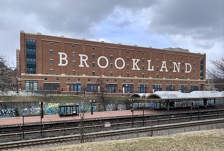
Photo: APK, CC BY-SA 4.0.
Brookland, Petworth, and Takoma are three relatively quiet neighborhoods east of Rock Creek Park. Following the "White Flight" after desegregation and the 1968 riots, these neighborhoods were left underpopulated, overwhelmingly African-American, and much less wealthy than the Upper Northwest, just across Rock Creek Park.
Michigan Park
Neighborhood
Michigan Park is a neighborhood in Ward 5 of Northeast Washington, D.C. in the Upper Northeast area element. The boundaries of Michigan Park and North Michigan Park neighborhoods are contested due to the history of racial disparity between the two, but…
Christ Crucified
- Type: Work of art
- Artwork type: sculpture
- Category: tourism
- Location: Washington, D.C., Mid-Atlantic, United States, North America
- View on OpenStreetMap
Latitude
38.93223° or 38° 55′ 56″ northLongitude
-77.00198° or 77° 0′ 7″ westOpen location code
87C4WXJX+V6OpenStreetMap ID
node 9512983797OpenStreetMap feature
tourism=artworkOpenStreetMap attribute
artwork_type=sculpture
This page is based on OpenStreetMap, Wikidata, and Wikimedia Commons.
We’d love your help improving our open data sources. Thank you for contributing.
Satellite Map
Discover Christ Crucified from above in high-definition satellite imagery.
Notable Places Nearby
Highlights include Rosary Walk & Garden and Mary’s Garden.
Nearby Places
Explore places such as Our Lady of Fatima and Michigan Ave NE at 4th St NE.
Washington, D.C.: Must-Visit Destinations
Delve into West End, Georgetown, East End, and Shaw.
Curious Work Of Arts to Discover
Uncover intriguing work of arts from every corner of the globe.
About Mapcarta. Data © OpenStreetMap contributors and available under the Open Database License". Text is available under the CC BY-SA 4.0 license, except for photos, directions, and the map. Photo: Peterfitzgerald, CC BY-SA 3.0.