Colline de Saint-Pierre
Colline de Saint-Pierre is a peak in Nice, Alpes-Maritimes, Provence-Alpes-Côte d’Azur and has an elevation of 245 metres. Colline de Saint-Pierre is situated nearby to the suburb Saint-Pierre-de-Féric, as well as near the quarter La Costière.| Tap on a place to explore it |
Places of Interest
Highlights include Allianz Riviera and Villa Arson.
Allianz Riviera
Stadium
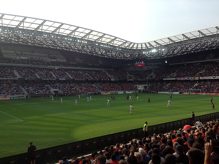
Photo: Mirasol, CC BY-SA 3.0.
Allianz Riviera is a multi-use stadium in Nice, France, mostly used for football matches of host OGC Nice and occasionally for home matches of rugby union club Toulon.
Villa Arson
University
 The Villa Arson, also referred to as the École Nationale Supérieure d'Arts à la Villa Arson, is a French art museum, elite school and research institution for contemporary art, located in Nice, France.
Russian Orthodox Cathedral, Nice
Church

Photo: Montgomery06, CC BY-SA 3.0.
The St Nicholas Orthodox Cathedral, Nice is an Eastern Orthodox cathedral located in the French city of Nice. Property of the Russian Federation, it is recognized as a national monument of France, and it currently belongs to the jurisdiction of the Moscow Patriarchate.
Places in the Area
Nearby places include Colomars and Saint-André-de-la-Roche.
Colomars
Village

Photo: Jpchevreau, CC BY-SA 3.0.
Colomars is a commune in the Alpes-Maritimes département in the Provence-Alpes-Côte d'Azur region in southeastern France. Inhabitants of Colomars are called Colomarsois.
Saint-André-de-la-Roche
Village

Photo: Jpchevreau, CC BY-SA 3.0.
Saint-André-de-la-Roche is a commune in the Alpes-Maritimes department in southeastern France. Until the 50s, in this small city there was a mountain with the shape of a shape-pyramid, similar to ancient pyramids from old civilizations.
Falicon
Village

Photo: Wikimedia, CC BY-SA 3.0.
Falicon is a commune in the Alpes-Maritimes department in southeastern France.
Colline de Saint-Pierre
- Type: Peak with an elevation of 245 metres
- Category: landform
- Location: Nice, Arrondissement of Nice, Alpes-Maritimes, Provence-Alpes-Côte d’Azur, France, Europe
- View on OpenStreetMap
Latitude
43.7219° or 43° 43′ 19″ northLongitude
7.228° or 7° 13′ 41″ eastElevation
245 metres (804 feet)Open location code
8FM9P6CH+Q6OpenStreetMap ID
node 9556053337OpenStreetMap feature
natural=peak
This page is based on OpenStreetMap, Wikidata, and Wikimedia Commons.
We’d love your help improving our open data sources. Thank you for contributing.
Satellite Map
Discover Colline de Saint-Pierre from above in high-definition satellite imagery.
Places with the Same Name
Discover other places named “Colline de Saint-Pierre”.
Localities in the Area
Explore places such as Saint-Pierre-de-Féric and La Costière.
Notable Places Nearby
Highlights include Viaduc de Magnan and EHPAD Les Jardins de la Clairière.
Alpes-Maritimes: Must-Visit Destinations
Delve into Cannes, Antibes, Menton, and Grasse.
Curious Peaks to Discover
Uncover intriguing peaks from every corner of the globe.
About Mapcarta. Data © OpenStreetMap contributors and available under the Open Database License". Text is available under the CC BY-SA 4.0 license, except for photos, directions, and the map. Photo: Michaelphillipr, CC BY-SA 3.0.