Pontohof
Pontohof is a farm in Runkel, Limburg-Weilburg, Hesse. Pontohof is situated nearby to the cemetery Friedhof Arfurt, as well as near the pitch Tennisplatz SV Arfurt.| Tap on a place to explore it |
Places of Interest Nearby
Highlights include St. Lambert and Arfurt station.
St. Lambert
Church

Photo: Asdrubal, CC BY-SA 3.0.
St. Lambert is a church, which is situated 360 metres southwest of Pontohof.
Arfurt station
Railway stop

Photo: Asdrubal, CC BY-SA 3.0.
Arfurt is a station in the Runkel district of Arfurt in the German state of Hesse on the Lahn Valley Railway. Arfurt station is situated 590 metres southeast of Pontohof.
Lahn-Marmor-Museum
Museum
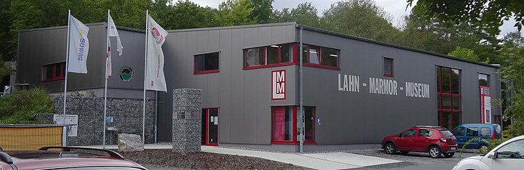
Photo: Christof Ellger, CC BY-SA 4.0.
Lahn-Marmor-Museum is situated 2 km southwest of Pontohof.
Places in the Area
Nearby places include Dauborn.
Dauborn
Village

Photo: Hintertaunus, Public domain.
Dauborn is a village, which is situated 9 km south of Pontohof.
Pontohof
- Type: Farm
- Categories: locality and agriculture
- Location: Runkel, Limburg-Weilburg, Giessen, Hesse, Germany, Central Europe, Europe
- View on OpenStreetMap
Latitude
50.40904° or 50° 24′ 33″ northLongitude
8.20333° or 8° 12′ 12″ eastOpen location code
9F2CC653+J8OpenStreetMap ID
node 9607416248OpenStreetMap feature
place=farm
This page is based on OpenStreetMap, Wikidata, and Wikimedia Commons.
We’d love your help improving our open data sources. Thank you for contributing.
Satellite Map
Discover Pontohof from above in high-definition satellite imagery.
Notable Places Nearby
Highlights include Friedhof Arfurt and Tennisplatz SV Arfurt.
Nearby Places
Explore places such as Marienhof and Tennisheim SV Arfurt.
Hesse: Must-Visit Destinations
Delve into Frankfurt, Wiesbaden, Darmstadt, and Kassel.
Curious Farms to Discover
Uncover intriguing farms from every corner of the globe.
About Mapcarta. Data © OpenStreetMap contributors and available under the Open Database License". Text is available under the CC BY-SA 4.0 license, except for photos, directions, and the map. Photo: Pedelecs, CC BY-SA 3.0.