Les Glareys
Les Glareys is a dwelling in Ollon, Aigle District, Vaud. Les Glareys is situated nearby to the fountain Fontaine, as well as near the village Bex.| Tap on a place to explore it |
Places of Interest Nearby
Highlights include Bex railway station and Bévieux station.
Bex railway station
Railway station

Photo: Roland Zumbuehl, CC BY-SA 4.0.
Bex railway station is a railway station in the municipality of Bex, in the Swiss canton of Vaud. It is an intermediate stop on the Simplon line and the terminus of the Bex–Villars–Bretaye line. Bex railway station is situated 2½ km south of Les Glareys.
Bévieux station
Railway station
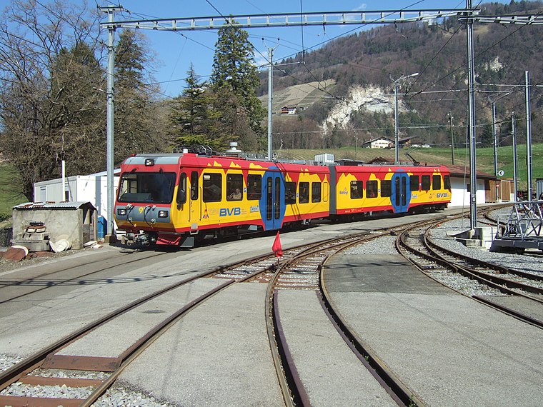
Photo: trams aux fils., CC BY 2.0.
Bévieux station is a railway station, which is situated 3 km southeast of Les Glareys.
Monthey railway station
Railway station

Photo: Espandero, CC BY-SA 4.0.
Monthey railway station is a railway station in the municipality of Monthey, in the Swiss canton of Valais. It is an intermediate stop on the Saint-Gingolph–Saint-Maurice line and is served by local trains only. Monthey railway station is situated 4 km southwest of Les Glareys.
Places in the Area
Nearby places include Bex and Huémoz.
Bex
Village

Photo: Björn S..., CC BY-SA 2.0.
Bex is a municipality in the canton of Vaud, Switzerland, located in the district of Aigle. It is a few kilometers south of its sister town municipality of Aigle. Bex is situated 2½ km south of Les Glareys.
Huémoz
Village
Photo: Emmanuelle Adjoa Bessi, CC BY-SA 4.0.
Huémoz is a village, which is situated 3 km northeast of Les Glareys.
Massongex
Village

Photo: Espandero, CC BY-SA 4.0.
Massongex is a municipality in the district of Saint-Maurice, in the canton of Valais, Switzerland. Massongex is situated 3½ km south of Les Glareys.
Les Glareys
- Type: Dwelling
- Categories: locality, residential building, and building
- Location: Ollon, Aigle District, Vaud, Western Switzerland, Switzerland, Central Europe, Europe
- View on OpenStreetMap
Latitude
46.27217° or 46° 16′ 20″ northLongitude
6.99994° or 6° 59′ 60″ eastOpen location code
8FR87XCX+VXOpenStreetMap ID
node 965049791OpenStreetMap feature
place=isolated_dwelling
This page is based on OpenStreetMap, Wikidata, and Wikimedia Commons.
We’d love your help improving our open data sources. Thank you for contributing.
Satellite Map
Discover Les Glareys from above in high-definition satellite imagery.
Notable Places Nearby
Highlights include Fontaine and Buchille.
Nearby Places
Explore places such as OP Auto-école sàrl and Salaz, Les Glareys.
Vaud: Must-Visit Destinations
Delve into Lausanne, Montreux, Nyon, and Vevey.
Curious Dwellings to Discover
Uncover intriguing dwellings from every corner of the globe.
About Mapcarta. Data © OpenStreetMap contributors and available under the Open Database License". Text is available under the CC BY-SA 4.0 license, except for photos, directions, and the map. Photo: Annickjaquillard, CC BY-SA 4.0.