Fashionwind
Fashionwind is a clothing store in Kerpen, Rhein-Erft-Kreis, North Rhine-Westphalia. Fashionwind is situated nearby to the library Stadtbücherei St. Martinus Kerpen, as well as near the mosque Emir Sultan Moschee.| Tap on a place to explore it |
Places of Interest Nearby
Highlights include St. Martinus and Johanneskirche.
St. Martinus
Church
 St. Martinus is a church, which is situated 120 metres northeast of Fashionwind.
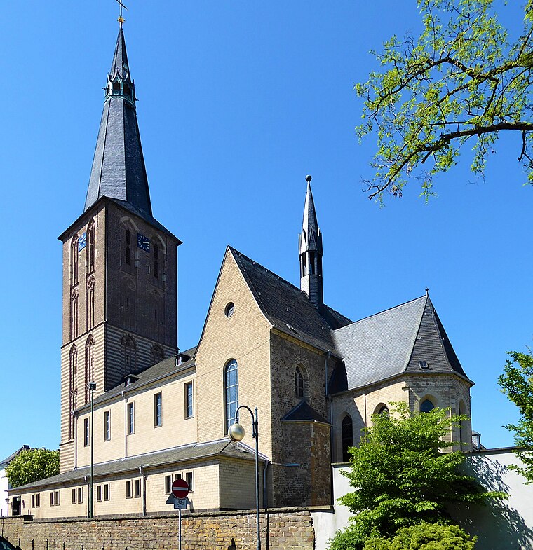
Johanneskirche
Church

Photo: Achim Raschka, CC BY-SA 4.0.
Johanneskirche is a church, which is situated 160 metres northwest of Fashionwind.
Jüdischer Friedhof
Cemetery
 Jüdischer Friedhof is a cemetery, which is situated 1½ km north of Fashionwind.
Places in the Area
Nearby places include Kerpen and Mödrath.
Kerpen
Town

Photo: A.Savin, CC BY-SA 3.0.
Kerpen is the most populated town in the Rhein-Erft-Kreis. It is located about 20 kilometres southwest from Cologne. As of 2023, Kerpen has a total population of 67,627.
Mödrath
Village
 Mödrath is a quarter of Kerpen, Germany. It was annexed to the Kerpen Ortskern in the course of the lignite resettlement in 1956.

Fashionwind
- Opening hours:
Tuesday—Friday: 10:00 AM—6:30 PM
Saturday: 10:00 AM—2:00 PM
public holidays: closed - Type: Clothing store
- Category: shop
- Location: Kerpen, Rhein-Erft-Kreis, Cologne District, North Rhine-Westphalia, Germany, Central Europe, Europe
- View on OpenStreetMap
Latitude
50.86891° or 50° 52′ 8″ northLongitude
6.69278° or 6° 41′ 34″ eastOpen location code
9F28VM9V+H4OpenStreetMap ID
node 9653832623OpenStreetMap feature
shop=clothes
This page is based on OpenStreetMap, Wikidata, and Wikimedia Commons.
We’d love your help improving our open data sources. Thank you for contributing.
Satellite Map
Discover Fashionwind from above in high-definition satellite imagery.
Notable Places Nearby
Highlights include Stadtbücherei St. Martinus Kerpen and Emir Sultan Moschee.
Nearby Places
Explore places such as Brillen-Studio and tipster.
North Rhine-Westphalia: Must-Visit Destinations
Delve into Cologne, Düsseldorf, Bonn, and Dortmund.
Curious Clothing Stores to Discover
Uncover intriguing clothing stores from every corner of the globe.
About Mapcarta. Data © OpenStreetMap contributors and available under the Open Database License". Text is available under the CC BY-SA 4.0 license, except for photos, directions, and the map. Photo: Daniel Schwen, CC BY-SA 2.5.