Temporary End of CT - Graysville Mountain
Temporary End of CT - Graysville Mountain is in Rhea, Tennessee. Temporary End of CT - Graysville Mountain is situated nearby to the quarry Lower Falls Mine, as well as near the waterfall Sale Creek Falls 40.| Tap on a place to explore it |
Places in the Area
Nearby places include Dayton and Ogden.
Dayton
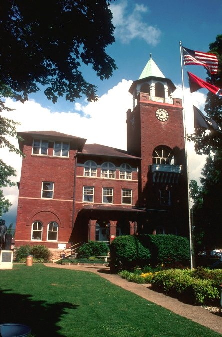
Photo: Calvin Beale, Public domain.
Dayton is a city in and the county seat of Rhea County, Tennessee, United States. As of the 2020 census, the city population was 7,065. The Dayton Urban Cluster includes developed areas adjacent to the city and extends south to Graysville.
Ogden
Hamlet
Ogden is an unincorporated community in Rhea County, Tennessee, United States. Ogden is located on Tennessee State Route 443 5.1 miles west of Dayton. Ogden is situated 3 miles west of Temporary End of CT - Graysville Mountain.
New Harmony
Hamlet
New Harmony is an unincorporated community in Bledsoe County, Tennessee. It lies in eastern Bledsoe County, south of Summer City and southeast of the city of Pikeville, the county seat of Bledsoe County. New Harmony is located along Tennessee State Route 443. New Harmony is situated 5 miles west of Temporary End of CT - Graysville Mountain.
Temporary End of CT - Graysville Mountain
- Type: Information
- Category: tourism
- Location: Rhea, Tennessee, South, United States, North America
- View on OpenStreetMap
Latitude
35.5245° or 35° 31′ 28″ northLongitude
-85.05071° or 85° 3′ 3″ westOpen location code
867PGWFX+QPOpenStreetMap ID
node 9675344533OpenStreetMap feature
tourism=information
This page is based on OpenStreetMap, Wikidata, and Wikimedia Commons.
We’d love your help improving our open data sources. Thank you for contributing.
Satellite Map
Discover Temporary End of CT - Graysville Mountain from above in high-definition satellite imagery.
Notable Places Nearby
Highlights include Lower Falls Mine and Sale Creek Falls 40.
Nearby Places
Explore places such as Waldens Ridge Elementary School and Dayton Pocket Boulders.
Tennessee: Must-Visit Destinations
Delve into Nashville, Memphis, Knoxville, and Chattanooga.
Curious Places to Discover
Uncover intriguing places from every corner of the globe.
About Mapcarta. Data © OpenStreetMap contributors and available under the Open Database License". Text is available under the CC BY-SA 4.0 license, except for photos, directions, and the map. Photo: Wikimedia, CC0.