Pfad der industriekultur
Pfad der industriekultur is in Forst, Spree-Neiße, Brandenburg. Pfad der industriekultur is situated nearby to Friedrichplatz, as well as near Max-Seydewitz-Platz.| Tap on a place to explore it |
Places of Interest Nearby
Highlights include Parish church St. Nikolai (Forst in der Lausitz) and Brandenburg Textile Museum Forst (Lausitz).
Parish church St. Nikolai (Forst in der Lausitz)
Church
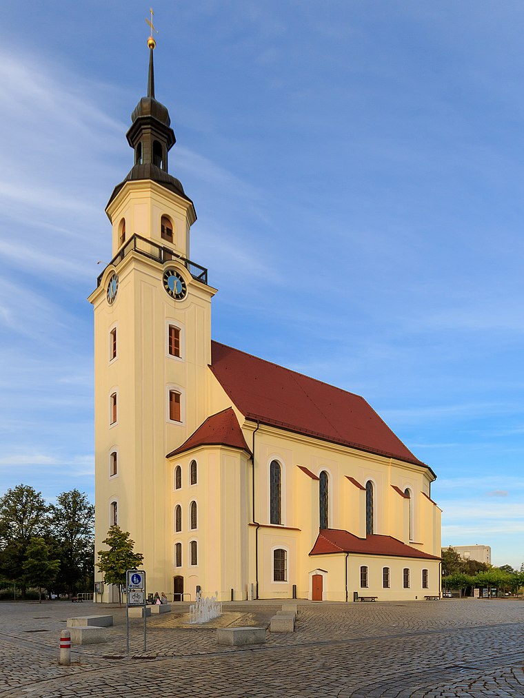 Parish church St. Nikolai (Forst in der Lausitz) is situated 210 metres north of Pfad der industriekultur.
Brandenburg Textile Museum Forst (Lausitz)
Museum

Photo: X-Weinzar, CC BY-SA 3.0.
Brandenburg Textile Museum Forst (Lausitz) is situated 400 metres south of Pfad der industriekultur.
Forst station
Railway station
 Forst /Baršć is a border railway station located in Forst, Germany. The station is located on the Cottbus–Forst railway and the former Forst–Guben and Weißwasser–Forst railway lines. Forst station is situated 770 metres southwest of Pfad der industriekultur.
Places in the Area
Nearby places include Zasieki and Horno.
Zasieki
Village

Photo: Wikimedia, CC BY-SA 3.0.
Zasieki is a village in the administrative district of Gmina Brody, within Żary County, Lubusz Voivodeship, in western Poland, on the border with Germany.


Pfad der industriekultur
- Type: Sign
- Categories: information and tourism
- Location: Forst, Spree-Neiße, Brandenburg, Germany, Central Europe, Europe
- View on OpenStreetMap
Latitude
51.74223° or 51° 44′ 32″ northLongitude
14.64692° or 14° 38′ 49″ eastOpen location code
9F3PPJRW+VQOpenStreetMap ID
node 9687518448OpenStreetMap feature
tourism=information
This page is based on OpenStreetMap, Wikidata, and Wikimedia Commons.
We’d love your help improving our open data sources. Thank you for contributing.
Satellite Map
Discover Pfad der industriekultur from above in high-definition satellite imagery.
Notable Places Nearby
Highlights include Friedrichplatz and Max-Seydewitz-Platz.
Nearby Places
Explore places such as Suchtberatung Forst and Torsten Laebe GmbH & Co. KG.
Brandenburg: Must-Visit Destinations
Delve into Potsdam, Cottbus, Frankfurt an der Oder, and Brandenburg an der Havel.
Curious Places to Discover
Uncover intriguing places from every corner of the globe.
About Mapcarta. Data © OpenStreetMap contributors and available under the Open Database License". Text is available under the CC BY-SA 4.0 license, except for photos, directions, and the map. Photo: Leviathan1983, CC BY-SA 3.0.