Wanderparkplatz Langholz
Wanderparkplatz Langholz is in Dogern, Waldshut, Baden-Württemberg. Wanderparkplatz Langholz is situated nearby to Obere Hatteläcker II, as well as near the fire station Freiwillige Feuerwehr Dogern.| Tap on a place to explore it |
Places of Interest Nearby
Highlights include St. Clemens (Dogern) and Dogern station.
St. Clemens (Dogern)
Church

Photo: Rauenstein, CC BY-SA 3.0.
St. Clemens (Dogern) is a church, which is situated 760 metres east of Wanderparkplatz Langholz.
Dogern station
Railway stop
 Dogern station is a railway station in the town of Dogern, Baden-Württemberg, Germany. The station lies on the High Rhine Railway. The train services are operated by Deutsche Bahn. Dogern station is situated 640 metres east of Wanderparkplatz Langholz.
Loreto chapel
Church

Photo: Rauenstein, CC BY-SA 3.0.
Loreto chapel is a church, which is situated 1½ km southeast of Wanderparkplatz Langholz.
Places in the Area
Nearby places include Leibstadt and Albbruck.
Leibstadt
Village
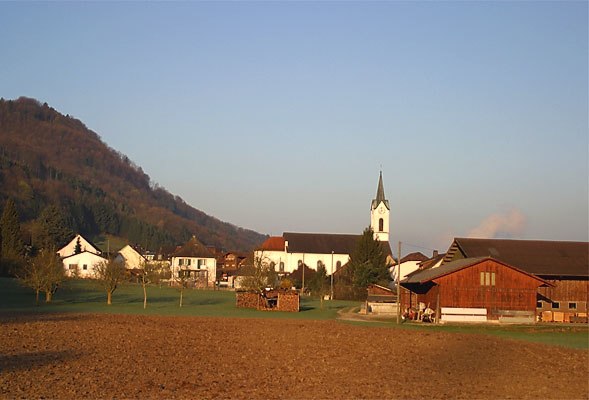
Photo: Wikimedia, CC BY-SA 3.0.
Leibstadt is a municipality in the district of Zurzach in the canton of Aargau in Switzerland.
Albbruck
Village

Photo: Schaema3, CC BY-SA 3.0.
Albbruck is a municipality of the district of Waldshut in Baden-Württemberg, Germany. It is on the southwestern border of Germany with Switzerland. Albbruck is situated 2½ km southwest of Wanderparkplatz Langholz.
Schwaderloch
Village
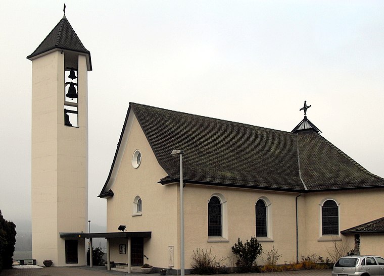
Photo: Rauenstein, CC BY-SA 3.0.
Schwaderloch is a municipality in the district of Laufenburg in the canton of Aargau in Switzerland. Schwaderloch is situated 3 km southwest of Wanderparkplatz Langholz.
Wanderparkplatz Langholz
- Type: Sign
- Categories: information and tourism
- Location: Dogern, Waldshut, Freiburg Region, Baden-Württemberg, Germany, Central Europe, Europe
- View on OpenStreetMap
Latitude
47.60862° or 47° 36′ 31″ northLongitude
8.15922° or 8° 9′ 33″ eastElevation
344 metres (1,129 feet)Operator
SchwarzwaldvereinOpen location code
8FVCJ555+CMOpenStreetMap ID
node 970068728OpenStreetMap feature
tourism=information
This page is based on OpenStreetMap, Wikidata, and Wikimedia Commons.
We’d love your help improving our open data sources. Thank you for contributing.
Satellite Map
Discover Wanderparkplatz Langholz from above in high-definition satellite imagery.
Notable Places Nearby
Highlights include Obere Hatteläcker II and Freiwillige Feuerwehr Dogern.
Nearby Places
Explore places such as DOWAKI and Sedus.
Baden-Württemberg: Must-Visit Destinations
Delve into Stuttgart, Heidelberg, Karlsruhe, and Mannheim.
Curious Places to Discover
Uncover intriguing places from every corner of the globe.
About Mapcarta. Data © OpenStreetMap contributors and available under the Open Database License". Text is available under the CC BY-SA 4.0 license, except for photos, directions, and the map. Photo: Traveler100, CC BY-SA 3.0.