Rua de Marracuene
Rua de Marracuene is in Cedofeita, Ildefonso, Sé, Miragaia, Nicolau, Vitória, Porto. Rua de Marracuene is situated nearby to Love2Dance, as well as near the church Cenáculo do Espírito Santo.| Tap on a place to explore it |
Places of Interest Nearby
Highlights include Casa da Música and Capela da Ramada Alta.
Casa da Música

Photo: xiquinhosilva, CC BY 2.0.
The Casa da Música is a concert hall in Porto, Portugal. It was designed by architect Rem Koolhaas and opened in 2005. Designed to mark the festive year of 2001 in which the city of Porto was designated European Capital of Culture, it was the first building… Casa da Música is situated 1 km west of Rua de Marracuene.
Capela da Ramada Alta
Church

Photo: Aoamen, CC BY-SA 3.0.
Capela da Ramada Alta is a church, which is situated 210 metres southwest of Rua de Marracuene.
Carolina Michaëlis station
Railway station
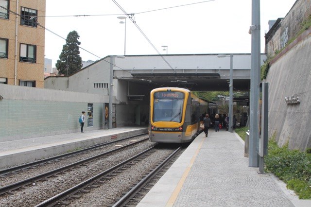
Photo: Ernstkers, CC BY-SA 4.0.
Carolina Michaëlis is a light rail station on the Porto Metro system in Porto, Portugal. The station is partly underground, beneath the Carolina Michaëlis de Vasconcelos stairway and in front of the Carolina Michaëlis Secondary School. It was opened in 2002. Carolina Michaëlis station is situated 410 metres south of Rua de Marracuene.
Places in the Area
Nearby places include Bouça Housing Complex and Cedofeita.
Bouça Housing Complex
Neighborhood

Photo: Aoamen, CC BY-SA 3.0.
Bouça Housing Complex is a neighborhood.
Cedofeita
Suburb

Photo: Aleksandr Zykov, CC BY-SA 2.0.
Cedofeita is a former civil parish in the municipality of Porto, Portugal. In 2013, the parish merged into the new parish Cedofeita, Santo Ildefonso, Sé, Miragaia, São Nicolau e Vitória.

Rua de Marracuene
- Type: Sign
- Inscription: “Rua de Marraguene; séx. XIX; Campanha de Moçambique; Antigo caminho do matadouro”
- Categories: information and tourism
- Location: Cedofeita, Ildefonso, Sé, Miragaia, Nicolau, Vitória, Porto, Porto District, Portugal, Iberia, Europe
- View on OpenStreetMap
Latitude
41.16209° or 41° 9′ 44″ northLongitude
-8.62047° or 8° 37′ 14″ westOpen location code
8CHH596H+RROpenStreetMap ID
node 9743999093OpenStreetMap feature
tourism=information
This page is based on OpenStreetMap, Wikidata, and Wikimedia Commons.
We’d love your help improving our open data sources. Thank you for contributing.
Satellite Map
Discover Rua de Marracuene from above in high-definition satellite imagery.
In Other Languages
“Rua de Marracuene” goes by many names.
- Portuguese: “Rua de Marracuene”
Notable Places Nearby
Highlights include Love2Dance and Cenáculo do Espírito Santo.
Nearby Places
Explore places such as Mercado Cruz de Cristo and BC óptica.
Portugal: Must-Visit Destinations
Delve into Lisbon, Caldas da Rainha, Coimbra, and Braga.
Curious Places to Discover
Uncover intriguing places from every corner of the globe.
About Mapcarta. Data © OpenStreetMap contributors and available under the Open Database License". Text is available under the CC BY-SA 4.0 license, except for photos, directions, and the map. Photo: Olegivvit, CC BY 2.5.