Hohenzollern-Kreuz
Hohenzollern-Kreuz is a wayside cross in Ettlingen, Karlsruhe, Baden-Württemberg. Hohenzollern-Kreuz is situated nearby to the archaeological site Redoute, as well as near the village Spessart.| Tap on a place to explore it |
Places of Interest Nearby
Highlights include Wattkopf and Ettlingen Palace.
Wattkopf
Peak
Wattkopf is a mountain of Baden-Württemberg, Germany. Wattkopf is situated 3½ km north of Hohenzollern-Kreuz.
Ettlingen Palace
Public building
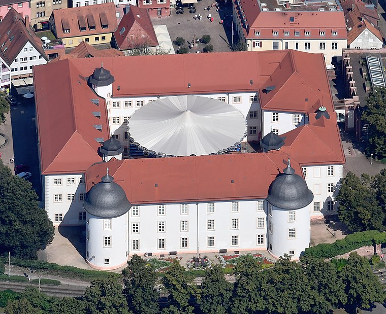
Photo: Carsten Steger, CC BY-SA 4.0.
Ettlingen Palace is a baroque palace in the centre of Ettlingen, a small city in Baden-Württemberg, Germany. Ettlingen Palace is situated 4 km north of Hohenzollern-Kreuz.
Busenbach railway station
Railway station
 Busenbach railway station is situated 3 km northeast of Hohenzollern-Kreuz.
Places in the Area
Nearby places include Spessart and Waldbronn.

Waldbronn
Town

Photo: Spacefrank, CC BY-SA 2.5.
Waldbronn is a municipality in the district of Karlsruhe, in Baden-Württemberg, Germany. It is situated in the northern Black Forest, 11 kilometres southeast of Karlsruhe. Waldbronn is situated 3½ km northeast of Hohenzollern-Kreuz.
Völkersbach
Village

Photo: Augenstein, CC BY-SA 3.0.
Völkersbach is a village, which is situated 4½ km southwest of Hohenzollern-Kreuz.
Hohenzollern-Kreuz
- Type: Wayside cross
- Category: historic site
- Location: Ettlingen, Karlsruhe, Karlsruhe Region, Rhine-Neckar, Baden-Württemberg, Germany, Central Europe, Europe
- View on OpenStreetMap
Latitude
48.90848° or 48° 54′ 31″ northLongitude
8.42463° or 8° 25′ 29″ eastInception
1725Open location code
8FWCWC5F+9VOpenStreetMap ID
node 974495079OpenStreetMap feature
historic=wayside_cross
This page is based on OpenStreetMap, Wikidata, and Wikimedia Commons.
We’d love your help improving our open data sources. Thank you for contributing.
Satellite Map
Discover Hohenzollern-Kreuz from above in high-definition satellite imagery.
Notable Places Nearby
Highlights include Redoute and Pfaffenbrunnen.
Nearby Places
Explore places such as Parkplatz Spessart and Funkturm Spessart.
Rhine-Neckar: Must-Visit Destinations
Delve into Heidelberg, Karlsruhe, Mannheim, and Heilbronn.
Curious Wayside Crosses to Discover
Uncover intriguing wayside crosses from every corner of the globe.
About Mapcarta. Data © OpenStreetMap contributors and available under the Open Database License". Text is available under the CC BY-SA 4.0 license, except for photos, directions, and the map. Photo: Martin-D, CC BY-SA 2.5.