Solfærgen Søhøjlandet
Solfærgen Søhøjlandet is in Silkeborg Municipality, Central Jutland. Solfærgen Søhøjlandet is situated nearby to the islet Svejbækø, as well as near the passenger ship terminal Aalekroen.| Tap on a place to explore it |
Places of Interest Nearby
Highlights include Svejbæk railway station and Ludvigslyst.
Svejbæk railway station
Railway station
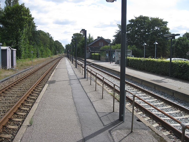
Photo: Alicudi, CC BY-SA 4.0.
Svejbæk station is a railway station serving the railway town of Svejbæk in Central Jutland, Denmark. The station is located on the Skanderborg–Skjern railway line from Skanderborg to Skjern. Svejbæk railway station is situated 680 metres north of Solfærgen Søhøjlandet.
Ludvigslyst
Restaurant

Photo: Wikimedia, Public domain.
Ludvigslyst is a restaurant, which is situated 450 metres north of Solfærgen Søhøjlandet.

Places in the Area
Nearby places include Sejs-Svejbæk and Linå.
Sejs-Svejbæk
Village
Sejs-Svejbæk is a railway town, with a population of 4,677. It is located in Silkeborg Municipality, Central Jutland Region in Denmark, 7 km southeast of Silkeborg.
Linå
Village

Photo: Nico-dk, CC BY-SA 3.0.
Linå is a village, with a population of 558, in Silkeborg Municipality, Central Denmark Region in Denmark. It is located 10 km east of Silkeborg and 34 km west of Aarhus Linå Church is located in the village. Linå is situated 4½ km northeast of Solfærgen Søhøjlandet.
Laven
Village

Photo: Nico, CC BY-SA 4.0.
Laven is a village, which is situated 5 km east of Solfærgen Søhøjlandet.
Solfærgen Søhøjlandet
- Type: Sign
- Categories: information and tourism
- Location: Silkeborg Municipality, Central Jutland, Denmark, Nordic countries, Europe
- View on OpenStreetMap
Latitude
56.12682° or 56° 7′ 37″ northLongitude
9.63907° or 9° 38′ 21″ eastOpen location code
9F8F4JGQ+PJOpenStreetMap ID
node 9812389871OpenStreetMap feature
tourism=information
This page is based on OpenStreetMap, Wikidata, and Wikimedia Commons.
We’d love your help improving our open data sources. Thank you for contributing.
Satellite Map
Discover Solfærgen Søhøjlandet from above in high-definition satellite imagery.
Notable Places Nearby
Highlights include Svejbækø and Aalekroen.
Nearby Places
Explore places such as Aalekroen and Skyttehuset Outdoor Camp.
Denmark: Must-Visit Destinations
Delve into Copenhagen, Aarhus, Odense, and Aalborg.
Curious Places to Discover
Uncover intriguing places from every corner of the globe.
About Mapcarta. Data © OpenStreetMap contributors and available under the Open Database License". Text is available under the CC BY-SA 4.0 license, except for photos, directions, and the map. Photo: Wikimedia, CC BY-SA 3.0.