Oberschongau
Oberschongau is a bus stop in Schongau, Hochdorf District, Canton of Lucerne. Oberschongau is situated nearby to the church Wallfahrtskriche St. Ulrich, as well as near the playground Wasserspielplatz.| Tap on a place to explore it |
Places of Interest Nearby
Highlights include Parish church St. Ulrich and Lindenberg.
Parish church St. Ulrich
Church

Photo: Roland Zumbuehl, CC BY-SA 4.0.
Parish church St. Ulrich is situated 1 km southwest of Oberschongau.
Lindenberg
Peak

Photo: DidiWeidmann, CC BY-SA 3.0.
The Lindenberg, peaking at 878 m, is a wooded hill in the Swiss Plateau north of the Alps, situated between the valleys of the Aabach, the Bünz and the Reuss.
Weissenbach sawmill
Museum

Photo: Roland Zumbuehl, CC BY-SA 3.0.
Weissenbach sawmill is a museum, which is situated 2 km east of Oberschongau.
Places in the Area
Nearby places include Bettwil and Buttwil.
Bettwil
Village

Photo: DidiWeidmann, CC BY-SA 3.0.
Bettwil is a municipality in the district of Muri in the canton of Aargau in Switzerland.
Buttwil
Village

Photo: DidiWeidmann, CC BY-SA 3.0.
Buttwil is a municipality in the district of Muri in the canton of Aargau in Switzerland. The village is 2 kilometers west of Muri. Buttwil is situated 2½ km east of Oberschongau.
Aesch
Village
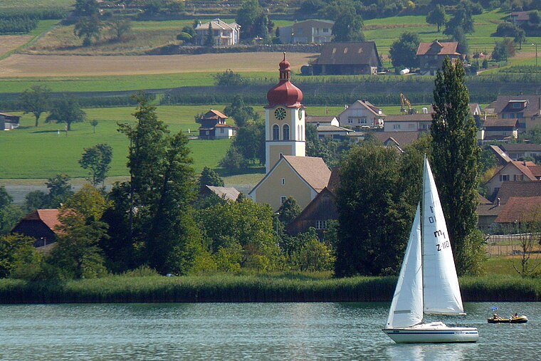
Photo: Wikimedia, Public domain.
Aesch is a municipality in the district of Hochdorf in the canton of Lucerne in Switzerland. Aesch is situated 3½ km southwest of Oberschongau.
Oberschongau
- Type: Bus stop
- Categories: transport stop and transportation
- Location: Schongau, Hochdorf District, Canton of Lucerne, Switzerland, Central Europe, Europe
- View on OpenStreetMap
Latitude
47.2729° or 47° 16′ 23″ northLongitude
8.27715° or 8° 16′ 38″ eastElevation
751 metres (2,464 feet)Operator
ZVBNetwork
PassepartoutOpen location code
8FVC77FG+5VOpenStreetMap ID
node 984024516OpenStreetMap feature
public_transport=stop_position
This page is based on OpenStreetMap, Wikidata, and Wikimedia Commons.
We’d love your help improving our open data sources. Thank you for contributing.
Satellite Map
Discover Oberschongau from above in high-definition satellite imagery.
Places with the Same Name
Discover other places named “Oberschongau”.
Notable Places Nearby
Highlights include Wallfahrtskriche St. Ulrich and Wasserspielplatz.
Nearby Places
Explore places such as Schongau, Oberschongau and Oberschongau.
Switzerland: Must-Visit Destinations
Delve into Zurich, Berne, Geneva, and Basel.
Curious Bus Stops to Discover
Uncover intriguing bus stops from every corner of the globe.
About Mapcarta. Data © OpenStreetMap contributors and available under the Open Database License". Text is available under the CC BY-SA 4.0 license, except for photos, directions, and the map. Photo: Simonizer, CC BY-SA 2.0 de.