Albacher Hof
Albacher Hof is a dwelling in Lich, Giessen, Hesse. Albacher Hof is situated nearby to the peak Höhler Berg, as well as near the nature reserve Hoher Stein bei Fernwald.| Tap on a place to explore it |
Places of Interest Nearby
Highlights include Hoher Stein bei Fernwald and Traumstern.
Hoher Stein bei Fernwald
Nature reserve

Photo: Cherubino, CC BY-SA 4.0.
Hoher Stein bei Fernwald is a nature reserve.
Traumstern
Movie theater
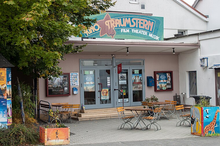
Photo: Stefan2901, CC BY-SA 3.0.
Traumstern is a movie theater, which is situated 2½ km southeast of Albacher Hof.
Die Mengelshäuser Teiche
Nature reserve

Photo: Cherubino, CC BY-SA 4.0.
Die Mengelshäuser Teiche is a nature reserve.
Places in the Area
Nearby places include Annerod and Holzheim.
Annerod
Village

Photo: Cherubino, CC BY-SA 4.0.
Annerod is a small village, part of the municipality Fernwald, in Germany between Gießen and Großen-Buseck approximately 70 km north of Frankfurt. Annerod has a population of about 3200 people. Annerod is situated 6 km northwest of Albacher Hof.

Albacher Hof
- Type: Dwelling
- Categories: locality, residential building, and building
- Location: Lich, Giessen, North Hesse, Hesse, Germany, Central Europe, Europe
- View on OpenStreetMap
Latitude
50.53955° or 50° 32′ 22″ northLongitude
8.79986° or 8° 47′ 60″ eastOpen location code
9F2CGQQX+RWOpenStreetMap ID
node 9847886927OpenStreetMap feature
place=isolated_dwelling
This page is based on OpenStreetMap, Wikidata, and Wikimedia Commons.
We’d love your help improving our open data sources. Thank you for contributing.
Satellite Map
Discover Albacher Hof from above in high-definition satellite imagery.
Notable Places Nearby
Highlights include Höhler Berg and FriedWald Lich.
Nearby Places
Explore places such as Albacher Hof and Oberer Albacher Teich.
North Hesse: Must-Visit Destinations
Delve into Kassel, Wetzlar, Marburg, and Fulda.
Curious Dwellings to Discover
Uncover intriguing dwellings from every corner of the globe.
About Mapcarta. Data © OpenStreetMap contributors and available under the Open Database License". Text is available under the CC BY-SA 4.0 license, except for photos, directions, and the map. Photo: Kreuzschnabel, CC BY-SA 3.0.