Bernd Riedel Eisenwaren
Bernd Riedel Eisenwaren is a hardware store in Mögglingen, Ostalbkreis, Baden-Württemberg. Bernd Riedel Eisenwaren is situated nearby to the church Christuskirche, as well as near the village Lautern.| Tap on a place to explore it |
Places of Interest Nearby
Highlights include Christuskirche and Rosenstein.
Christuskirche
Church

Photo: Aalen1, CC BY-SA 4.0.
Christuskirche is a church, which is situated 1 km west of Bernd Riedel Eisenwaren.
Rosenstein
Peak
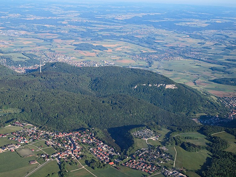
Photo: Kreuzschnabel, CC BY-SA 3.0.
The Rosenstein is a 735 m high mountain in the Swabian Jura above the town of Heubach near Schwäbisch Gmünd, Germany. With its exposed position as head of the Alb it had been of strategic importance. Rosenstein is situated 3 km southwest of Bernd Riedel Eisenwaren.
Mögglingen station
Railway stop

Photo: 5R-MFT, CC BY-SA 4.0.
Mögglingen station is a railway stop in the municipality of Mögglingen, located in the Ostalbkreis district in Baden-Württemberg, Germany. The station lies on the Rems Railway. The train services are operated by Go-Ahead Baden-Württemberg. Mögglingen station is situated 1½ km west of Bernd Riedel Eisenwaren.
Places in the Area
Nearby places include Lautern and Essingen.

Essingen
Village

Photo: Wikimedia, CC BY-SA 4.0.
Essingen is a municipality in the Ostalbkreis in the State of Baden-Württemberg in Germany. It lies about 73 km east of Stuttgart, just outside the city of Aalen. Essingen is situated 4 km southeast of Bernd Riedel Eisenwaren.
Böbingen an der Rems
Village

Photo: Mediatus, CC BY-SA 3.0.
Böbingen an der Rems is a municipality in the German state of Baden-Württemberg, in Ostalbkreis district. It lies on the river Rems. Böbingen an der Rems is situated 4 km west of Bernd Riedel Eisenwaren.
Bernd Riedel Eisenwaren
- Type: Hardware store
- Category: shop
- Location: Mögglingen, Ostalbkreis, Stuttgart, Baden-Württemberg, Germany, Central Europe, Europe
- View on OpenStreetMap
Latitude
48.82199° or 48° 49′ 19″ northLongitude
9.97866° or 9° 58′ 43″ eastOpen location code
8FWFRXCH+QFOpenStreetMap ID
node 9865410029OpenStreetMap feature
shop=hardware
This page is based on OpenStreetMap, Wikidata, and Wikimedia Commons.
We’d love your help improving our open data sources. Thank you for contributing.
Satellite Map
Discover Bernd Riedel Eisenwaren from above in high-definition satellite imagery.
Notable Places Nearby
Highlights include Spielplatz Schillerstraße and Milli Görus Moschee.
Nearby Places
Explore places such as HUMA Farben GmbH and GTS Generator. Technik. Systeme. GmbH & Co. KG.
Baden-Württemberg: Must-Visit Destinations
Delve into Stuttgart, Heidelberg, Karlsruhe, and Mannheim.
Curious Hardware Stores to Discover
Uncover intriguing hardware stores from every corner of the globe.
About Mapcarta. Data © OpenStreetMap contributors and available under the Open Database License". Text is available under the CC BY-SA 4.0 license, except for photos, directions, and the map. Photo: Traveler100, CC BY-SA 3.0.