St.Georgen Brunnenplatz
St.Georgen Brunnenplatz is a bus stop in Villach, Carinthia. St.Georgen Brunnenplatz is situated nearby to the church Filialkirche Sankt Georgen, as well as near the cemetery Pogöriacher Friedhof.| Tap on a place to explore it |
Places of Interest Nearby
Highlights include Filialkirche Sankt Georgen and Villacher Alpenarena.
Filialkirche Sankt Georgen
Church
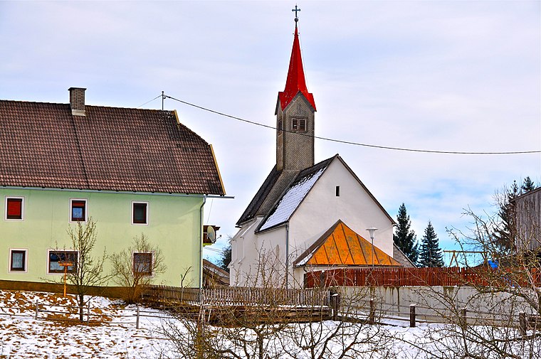
Photo: Johann Jaritz, CC BY-SA 3.0 at.
Filialkirche Sankt Georgen is a church, which is situated 110 metres northeast of St.Georgen Brunnenplatz.
Villacher Alpenarena
Sports venue

Photo: Eggermanuel, CC BY-SA 3.0.
Villacher Alpenarena is a ski jumping hill in Villach, Austria. Villacher Alpenarena is situated 1½ km south of St.Georgen Brunnenplatz.
Stadthalle
Stadium

Photo: Mefusbren69, Public domain.
Stadthalle Villach is an indoor sporting arena located in Villach, Austria. The arena has a capacity of 4,500 people and was built in 1969. It is currently home to the EC VSV ice hockey team of the Austrian Hockey League. Stadthalle is situated 2 km east of St.Georgen Brunnenplatz.
Places in the Area
Nearby places include Maria Gail and Fürnitz.
Maria Gail
Suburb

Photo: Johann Jaritz, CC BY-SA 4.0.
Maria Gail is a suburb, which is situated 6 km east of St.Georgen Brunnenplatz.
Fürnitz
Village

Photo: Zeberus, CC BY-SA 3.0.
Fürnitz is a village, which is situated 6 km south of St.Georgen Brunnenplatz.
Landskron
Suburb

Photo: Bwag, CC BY-SA 4.0.
Landskron is a suburb, which is situated 7 km east of St.Georgen Brunnenplatz.
St.Georgen Brunnenplatz
- Type: Bus stop
- Categories: transport stop and transportation
- Location: Villach, Carinthia, Austria, Central Europe, Europe
- View on OpenStreetMap
Latitude
46.61833° or 46° 37′ 6″ northLongitude
13.80344° or 13° 48′ 12″ eastOperator
ÖBB-PostbusNetwork
Stadtverkehr Villach - Linie 5175Open location code
8FRMJR93+89OpenStreetMap ID
node 9868360101OpenStreetMap feature
public_transport=stop_position
This page is based on OpenStreetMap, Wikidata, and Wikimedia Commons.
We’d love your help improving our open data sources. Thank you for contributing.
Satellite Map
Discover St.Georgen Brunnenplatz from above in high-definition satellite imagery.
Notable Places Nearby
Highlights include Pogöriacher Friedhof and Pferdekoppel.
Nearby Places
Explore places such as Gasthaus Wiegele and Badstraße.
Carinthia: Must-Visit Destinations
Delve into Klagenfurt, Wörthersee, Spittal an der Drau, and Friesach.
Curious Bus Stops to Discover
Uncover intriguing bus stops from every corner of the globe.
About Mapcarta. Data © OpenStreetMap contributors and available under the Open Database License". Text is available under the CC BY-SA 4.0 license, except for photos, directions, and the map. Photo: Wikimedia, CC BY-SA 3.0.