Kopa nad Váhou
Kopa nad Váhou is a peak in Slovakia and has an elevation of 2,385 metres. Kopa nad Váhou is situated nearby to the locality Jelenia lúka, as well as near Zlomisková roveň.| Tap on a place to explore it |
Photo: Gower, CC BY-SA 4.0.
Places of Interest
Highlights include Rysy and Eye of the Sea.
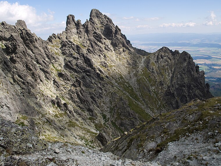
Rysy
Peak

Photo: Wikimedia, CC BY-SA 2.5.
Rysy is a mountain in the crest of the High Tatras, eastern part of the Tatra Mountains, lying on the border between Poland and Slovakia. Rysy has three summits: the middle at 2,501 m; the north-western at 2,500 m; and the south-eastern at 2,473 m.
Eye of the Sea
Lake

Photo: Tomasz O., Public domain.
Morskie Oko, or Eye of the Sea in English, is the largest and fourth-deepest lake in the Tatra Mountains, in southern Poland. It is located deep within the Tatra National Park in the Rybi Potok Valley, of the High Tatras mountain range at the base of the Mięguszowiecki Summits, in Lesser Poland Voivodeship.
Gerlachovský štít
Peak

Photo: Kristo, CC BY-SA 3.0.
Gerlachovský štít, informally referred to as Gerlach, is the highest peak in the High Tatras, in Slovakia, and in the Carpathian Mountains. Its elevation is usually listed at 2654.4 m above sea level.
Places in the Area
Nearby places include Rovienky and Granátová stena.

Štrbské Pleso
Suburb

Photo: Rafik k, CC BY-SA 4.0.
Štrbské Pleso is a ski, tourist, and health resort in the High Tatras, Slovakia located on the lake by the same name. With extensive parking facilities and a stop on the Tatra trolley and rack railway, it is a starting point for a host of popular hikes including to Kriváň and Rysy.
Kopa nad Váhou
- Type: Peak with an elevation of 2,385 metres
- Categories: mountain and landform
- Location: Slovakia, Central Europe, Europe
- View on OpenStreetMap
Latitude
49.1773° or 49° 10′ 39″ northLongitude
20.0891° or 20° 5′ 21″ eastElevation
2,385 metres (7,825 feet)Open location code
8GX253GQ+WJOpenStreetMap ID
node 9899041586OpenStreetMap feature
natural=peakWikidata ID
Q11743311
This page is based on OpenStreetMap, Wikidata, and Wikimedia Commons.
We’d love your help improving our open data sources. Thank you for contributing.
Satellite Map
Discover Kopa nad Váhou from above in high-definition satellite imagery.
In Other Languages
From Ladin to Slovak—“Kopa nad Váhou” goes by many names.
- Ladin: “Kopa nad Váhou”
- Polish: “Kopa nad Váhou”
- Polish: “Kopa nad Wagą”
- Slovak: “Kopa nad Váhou”
Localities in the Area
Explore places such as Jelenia lúka and Zlomisková roveň.
Notable Places Nearby
Highlights include Rysy and Váha.
Slovakia: Must-Visit Destinations
Delve into Bratislava, Košice, Banská Bystrica, and Trnava.
Curious Peaks to Discover
Uncover intriguing peaks from every corner of the globe.
About Mapcarta. Data © OpenStreetMap contributors and available under the Open Database License". Text is available under the CC BY-SA 4.0 license, except for photos, directions, and the map. Photo: Gower, CC BY-SA 4.0.