Aquilaria Kosmetik
Aquilaria Kosmetik is a beauty salon in Waake, Göttingen, Lower Saxony which is located on Burgstraße. Aquilaria Kosmetik is situated nearby to the town hall Gemeindeverwaltung Waake, as well as near the village green Thie.| Tap on a place to explore it |
Places of Interest Nearby
Highlights include Mackenröder Spitze and European Bread Museum.
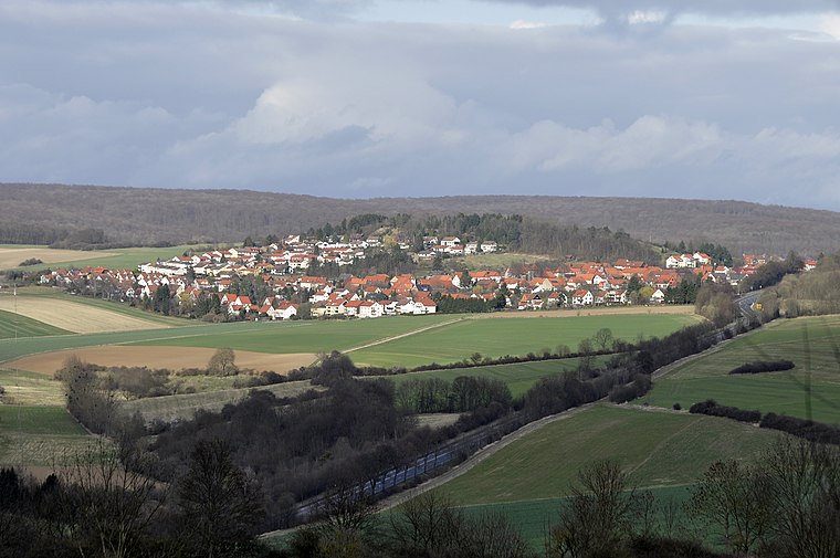
Mackenröder Spitze
Peak

Photo: Ramessos, Public domain.
The Mackenröder Spitze, at about 427.5 m above sea level, is the highest hill in the Göttingen Forest and lies on the boundary of the town and district of Göttingen, in South Lower Saxony in Germany.
European Bread Museum
Museum

Photo: Schnute22, CC BY-SA 3.0.
The European Bread Museum, in Ebergötzen in South Lower Saxony, Germany, is a rurally located museum dedicated to the historical development of breadmaking and related subjects in Europe. European Bread Museum is situated 3½ km northeast of Aquilaria Kosmetik.
Hünstollen
Peak

Photo: Castritus, CC BY-SA 4.0.
Hünstollen is a peak, which is situated 2½ km north of Aquilaria Kosmetik.
Places in the Area
Nearby places include Bösinghausen and Roringen.

Roringen
Suburb
 Roringen is a village in the borough of Göttingen, Germany. High on a hill, it is separated from the city proper some 51⁄2 km to the south-west by farmlands and part of the Göttingen Forest. Roringen is situated 3½ km west of Aquilaria Kosmetik.
Falkenhagen
Village
Falkenhagen is a village in the municipality Landolfshausen, in the district of Göttingen of Lower Saxony, Germany. Falkenhagen is situated 5 km southeast of Aquilaria Kosmetik.
Aquilaria Kosmetik
- Type: Beauty salon
- Address: Burgstraße 13, Waake, 37136
- Category: shop
- Location: Waake, Göttingen, Lower Saxony, Germany, Central Europe, Europe
- View on OpenStreetMap
Latitude
51.55513° or 51° 33′ 19″ northLongitude
10.05597° or 10° 3′ 22″ eastOpen location code
9F3GH344+39OpenStreetMap ID
node 9921655757OpenStreetMap feature
shop=beauty
This page is based on OpenStreetMap, Wikidata, and Wikimedia Commons.
We’d love your help improving our open data sources. Thank you for contributing.
Satellite Map
Discover Aquilaria Kosmetik from above in high-definition satellite imagery.
Notable Places Nearby
Highlights include Gemeindeverwaltung Waake and Thie.
Nearby Places
Explore places such as Dorfschmiede and Radwanderkarte Landkreis Göttingen.
Lower Saxony: Must-Visit Destinations
Delve into Hanover, Göttingen, Brunswick, and Wolfsburg.
Curious Beauty Salons to Discover
Uncover intriguing beauty salons from every corner of the globe.
About Mapcarta. Data © OpenStreetMap contributors and available under the Open Database License". Text is available under the CC BY-SA 4.0 license, except for photos, directions, and the map. Photo: Danapit, CC BY-SA 3.0.