Vanes foraneas
Vanes foraneas is a bus stop in Tulum Municipality, Quintana Roo. Vanes foraneas is situated nearby to the hospital orthotulum, as well as near the forest Árbol.| Tap on a place to explore it |
Places of Interest Nearby
Highlights include Temple of Doom.
Temple of Doom
Cave
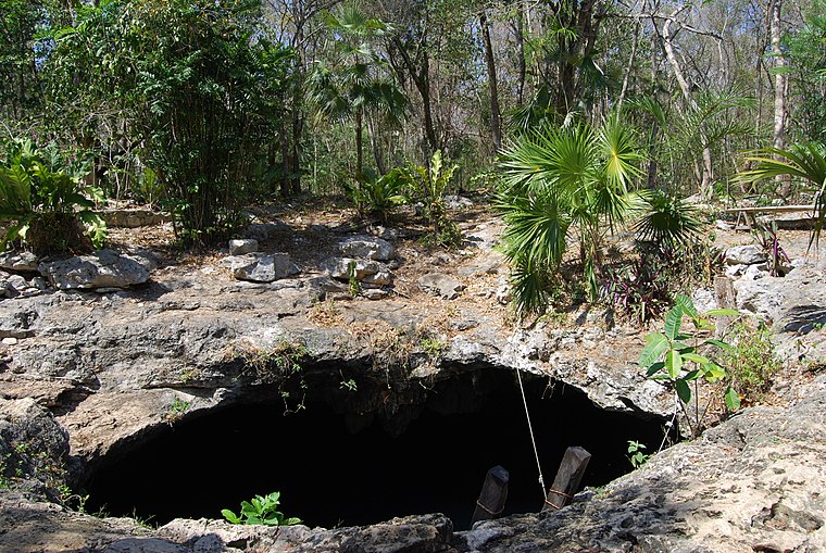
Photo: Offthebeatonpath, CC BY-SA 4.0.
Temple of Doom is a cave, which is situated 3 km northeast of Vanes foraneas.
Places in the Area
Nearby places include Tulum.
Tulum
Town

Photo: Dennis G. Jarvis, CC BY-SA 2.0.
Tulum is the largest community in the municipality of Tulum, Quintana Roo, Mexico. It is located on the Caribbean coast of the state, near the site of the archaeological ruins of Tulum.
Vanes foraneas
- Type: Bus stop
- Category: transportation
- Location: Tulum Municipality, Quintana Roo, Yucatán and the South, Mexico, North America
- View on OpenStreetMap
Latitude
20.20679° or 20° 12′ 25″ northLongitude
-87.47582° or 87° 28′ 33″ westOpen location code
76GJ6G4F+PMOpenStreetMap ID
node 9963091103OpenStreetMap feature
highway=bus_stopOpenStreetMap feature
public_transport=platform
This page is based on OpenStreetMap, Wikidata, and Wikimedia Commons.
We’d love your help improving our open data sources. Thank you for contributing.
Satellite Map
Discover Vanes foraneas from above in high-definition satellite imagery.
Places with the Same Name
Discover other places named “Vanes foraneas”.
Notable Places Nearby
Highlights include Árbol and orthotulum.
Nearby Places
Explore places such as Total Concrete and Berel.
Quintana Roo: Must-Visit Destinations
Delve into Cancún, Chetumal, Playa del Carmen, and Tulum.
Curious Bus Stops to Discover
Uncover intriguing bus stops from every corner of the globe.
About Mapcarta. Data © OpenStreetMap contributors and available under the Open Database License". Text is available under the CC BY-SA 4.0 license, except for photos, directions, and the map. Photo: Wikimedia, CC0.