BP
BP is a gas station in Middlesex, Massachusetts. BP is situated nearby to the park Hyde Playground, as well as near Newton Highland Congregational Church.| Tap on a place to explore it |
Places of Interest Nearby
Highlights include Eliot station and Newton Highlands station.
Eliot station
Railway stop

Photo: Pi.1415926535, CC BY-SA 3.0.
Eliot station is a light rail station on the MBTA Green Line D branch located just north of Route 9 between the Newton Highlands and Newton Upper Falls villages of Newton, Massachusetts. Eliot station is situated 1,600 feet west of BP.
Newton Highlands station
Railway stop

Photo: Pi.1415926535, CC BY-SA 4.0.
Newton Highlands station is a surface-level light rail station located in Newton, Massachusetts on the Green Line D branch of the Massachusetts Bay Transportation Authority. Newton Highlands station is situated 1,900 feet northeast of BP.
Mary Immaculate of Lourdes Church
Church

Photo: Lukascb, CC BY-SA 3.0.
Mary Immaculate of Lourdes Church, formerly referred to as St. Mary's, is a Roman Catholic parish of the Archdiocese of Boston located in Newton Upper Falls, Massachusetts. Mary Immaculate of Lourdes Church is situated 3,600 feet southwest of BP.
Places in the Area
Nearby places include Newton Upper Falls and Newton Centre.
Newton Upper Falls
Quarter

Photo: Magicpiano, CC BY-SA 4.0.
Newton Upper Falls is one of the thirteen villages within the city of Newton in Massachusetts, United States. The village is listed as the Newton Upper Falls Historic District on the National Register of Historic Places.
Newton Centre
Village
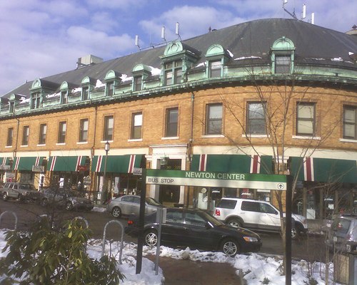
Photo: Mshteinie, CC BY-SA 3.0.
Newton Centre is one of the thirteen villages within the city of Newton in Middlesex County, Massachusetts, United States. The main commercial center of Newton Centre is a triangular area surrounding the intersections of Beacon Street, Centre Street, and Langley Road.
Waban
Quarter
 Waban is one of the thirteen villages within the city of Newton in Middlesex County, Massachusetts, United States.
BP
- Type: Gas station
- Category: transportation
- Location: Middlesex, Massachusetts, New England, United States, North America
- View on OpenStreetMap
Latitude
42.31894° or 42° 19′ 8″ northLongitude
-71.21085° or 71° 12′ 39″ westBrand
BPOpen location code
87JC8Q9Q+HMOpenStreetMap ID
node 9966247849OpenStreetMap feature
amenity=fuel
This page is based on OpenStreetMap, Wikidata, and Wikimedia Commons.
We’d love your help improving our open data sources. Thank you for contributing.
Satellite Map
Discover BP from above in high-definition satellite imagery.
Notable Places Nearby
Highlights include Hyde Playground and Newton Highland Congregational Church.
Nearby Places
Explore places such as Dunkin‘ and Woodward St @ Boylston St.
Massachusetts: Must-Visit Destinations
Delve into Boston, Cambridge, Springfield, and Worcester.
Curious Gas Stations to Discover
Uncover intriguing gas stations from every corner of the globe.
About Mapcarta. Data © OpenStreetMap contributors and available under the Open Database License". Text is available under the CC BY-SA 4.0 license, except for photos, directions, and the map. Photo: papadunes, CC BY-SA 3.0.