Croix le Sacré-Coeur
Croix le Sacré-Coeur is a wayside cross in Hérault, Occitanie. Croix le Sacré-Coeur is situated nearby to the social service facility EHPAD Mireille Vidal, as well as near the pitch Boulodrome.| Tap on a place to explore it |
Places of Interest Nearby
Highlights include Abbaye de Saint-Thibéry and Église Saint-Thibéry de Saint-Thibéry.
Abbaye de Saint-Thibéry
Monastery

Photo: Fagairolles 34, CC BY-SA 4.0.
Abbaye de Saint-Thibéry is a monastery, which is situated 380 metres west of Croix le Sacré-Coeur.
Église Saint-Thibéry de Saint-Thibéry
Church
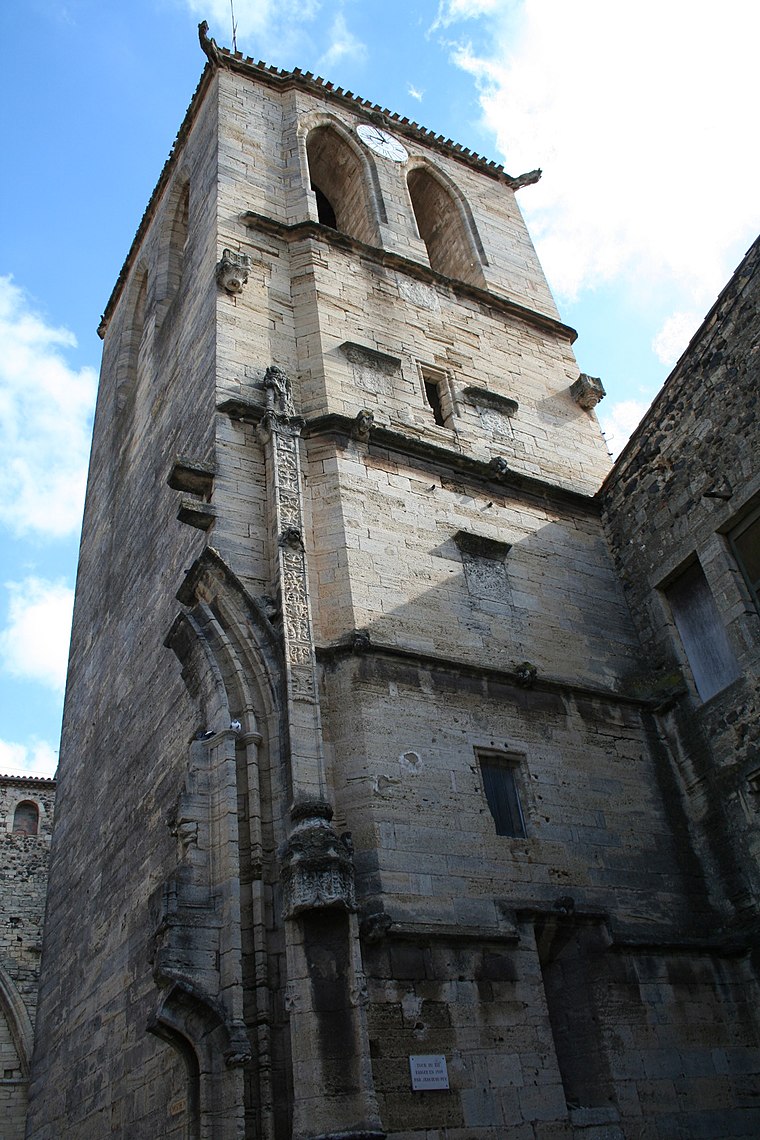
Photo: Fagairolles 34, CC BY-SA 4.0.
Église Saint-Thibéry de Saint-Thibéry is a church, which is situated 390 metres northwest of Croix le Sacré-Coeur.
Roman Bridge
Ruins

Photo: Fagairolles 34, CC BY-SA 4.0.
The Roman Bridge at Saint-Thibéry was a Roman bridge on the Via Domitia in southern France. The partly surviving structure crossed the river Hérault in Saint-Thibéry, 17 km east of Béziers. Roman Bridge is situated 1 km east of Croix le Sacré-Coeur.
Places in the Area
Nearby places include Pomerols and Pézenas.
Pomerols

Photo: Fagairolles 34, CC BY-SA 4.0.
Pomérols is a commune in the Hérault department in the Occitanie region in southern France.
Pézenas

Photo: Christian Ferrer, CC BY-SA 4.0.
Pézenas is a commune in the Hérault department in the Occitanie region in southern France.
Marseillan
Village

Photo: Marseillan34340, CC BY-SA 4.0.
Marseillan is a resort town and commune in the Hérault department in southern France. As of 2022, the population of Marseillan is 8,047. The port of Marseillan is a protected heritage site, and the altar and organ in the church are also listed. Marseillan is situated 10 km southeast of Croix le Sacré-Coeur.
Croix le Sacré-Coeur
- Type: Wayside cross
- Category: historic site
- Location: Hérault, Occitanie, France, Europe
- View on OpenStreetMap
Latitude
43.39583° or 43° 23′ 45″ northLongitude
3.42215° or 3° 25′ 20″ eastOpen location code
8FM59CWC+8VOpenStreetMap ID
node 9976054159OpenStreetMap feature
historic=wayside_cross
This page is based on OpenStreetMap, Wikidata, and Wikimedia Commons.
We’d love your help improving our open data sources. Thank you for contributing.
Satellite Map
Discover Croix le Sacré-Coeur from above in high-definition satellite imagery.
Notable Places Nearby
Highlights include EHPAD Mireille Vidal and Boulodrome.
Nearby Places
Explore places such as Lotissement Le Clos de Melody and Sainte-Colombe.
Hérault: Must-Visit Destinations
Delve into Montpellier, Béziers, Sète, and Bouzigues.
Curious Wayside Crosses to Discover
Uncover intriguing wayside crosses from every corner of the globe.
About Mapcarta. Data © OpenStreetMap contributors and available under the Open Database License". Text is available under the CC BY-SA 4.0 license, except for photos, directions, and the map. Photo: Ondřej Žváček, CC BY 2.5.