Pozsgaitanya
Pozsgaitanya is a farm in Győr-Moson-Sopron County, Western Transdanubia. Pozsgaitanya is situated nearby to the zoo Kimba Animal Park & Restaurant.| Tap on a place to explore it |
Places in the Area
Nearby places include Adyváros and Pázmándfalu.
Adyváros
Suburb

Photo: Андрей Романенко, CC BY-SA 4.0.
Adyváros is a suburb, which is situated 8 km northwest of Pozsgaitanya.
Pázmándfalu
Village

Photo: Pasztilla, CC BY-SA 4.0.
Pázmándfalu is a village in Győr-Moson-Sopron county, Hungary. In the 14th century it was property of the Cseszneky family. Pázmándfalu is situated 8 km south of Pozsgaitanya.
Győr
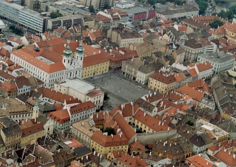 Győr is a city in Western Transdanubia in Hungary. It is called A barokk városa, because the old part of the city contains dozens of monumental buildings and sculptures from the 18th century.
Pozsgaitanya
- Type: Farm
- Categories: locality and agriculture
- Location: Győr-Moson-Sopron County, Western Transdanubia, Hungary, Central Europe, Europe
- View on OpenStreetMap
Latitude
47.6398° or 47° 38′ 23″ northLongitude
17.74565° or 17° 44′ 44″ eastOpen location code
8FVVJPQW+W7OpenStreetMap ID
node 999281608OpenStreetMap feature
place=farm
This page is based on OpenStreetMap, Wikidata, and Wikimedia Commons.
We’d love your help improving our open data sources. Thank you for contributing.
Satellite Map
Discover Pozsgaitanya from above in high-definition satellite imagery.
Places with the Same Name
Discover other places named “Pozsgaitanya”.
Notable Places Nearby
Highlights include Kimba Animal Park & Restaurant and Dr. Piróth Endre Mentálhigiénés Otthon.
Nearby Places
Explore places such as Kimba Cafe & Restaurant and Töltéstavai elágazás.
Győr-Moson-Sopron County: Must-Visit Destinations
Delve into Sopron, Győr, Mosonmagyaróvár, and Fertőd.
Curious Farms to Discover
Uncover intriguing farms from every corner of the globe.
About Mapcarta. Data © OpenStreetMap contributors and available under the Open Database License". Text is available under the CC BY-SA 4.0 license, except for photos, directions, and the map. Photo: Wikimedia, CC0.