Microtel Inn & Suites by Wyndham Conyers Atlanta Area
Microtel Inn & Suites by Wyndham Conyers Atlanta Area is a hotel in Rockdale, Georgia which is located on Old McDonough Highway Southeast. Microtel Inn & Suites by Wyndham Conyers Atlanta Area is situated nearby to the health club LA Fitness, as well as near Republican Grove Baptist Church Cemetery.| Tap on a place to explore it |
- Type: Hotel
- Also known as: “Microtel Inn & Suites by Wyndham”
- Address: 1412 Old McDonough Highway Southeast, Conyers, GA 30094
Places in the Area
Nearby places include Conyers and Lakeview Estates.
Conyers
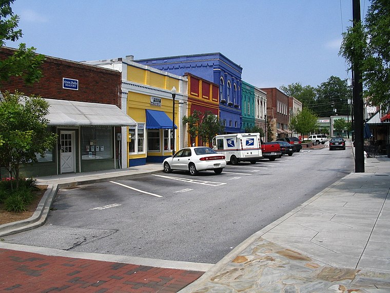 Conyers is a city and the county seat of Rockdale County, Georgia, United States. The city is 24 miles east of downtown Atlanta and is a part of the Atlanta metropolitan area.
Lakeview Estates
Village
Lakeview Estates, also known as Sunrise Lakes by local residents, is an unincorporated community and census-designated place in Rockdale County, Georgia, United States. The population was 2,660 in 2020. Lakeview Estates is situated 4 miles north of Microtel Inn & Suites by Wyndham Conyers Atlanta Area.
Microtel Inn & Suites by Wyndham Conyers Atlanta Area
- Categories: building, tourism, and accommodation
- Location: Rockdale, Georgia, South, United States, North America
- View on OpenStreetMap
Latitude
33.65278° or 33° 39′ 10″ northLongitude
-84.01038° or 84° 0′ 37″ westOpen location code
865QMX3Q+4ROpenStreetMap ID
way 1000007582OpenStreetMap feature
building=yesOpenStreetMap feature
tourism=hotel
This page is based on OpenStreetMap, Wikidata, and Wikimedia Commons.
We’d love your help improving our open data sources. Thank you for contributing.
Satellite Map
Discover Microtel Inn & Suites by Wyndham Conyers Atlanta Area from above in high-definition satellite imagery.
Notable Places Nearby
Highlights include LA Fitness and Republican Grove Baptist Church Cemetery.
Nearby Places
Explore places such as Burlington and Cici Pizza.
Georgia: Must-Visit Destinations
Delve into Atlanta, Savannah, Augusta, and Hartsfield–Jackson Atlanta International Airport.
Curious Hotels to Discover
Uncover intriguing hotels from every corner of the globe.
About Mapcarta. Data © OpenStreetMap contributors and available under the Open Database License". Text is available under the CC BY-SA 4.0 license, except for photos, directions, and the map. Photo: Wikimedia, CC0.