Centre de secours principal Nice-Bon Voyage
Centre de secours principal Nice-Bon Voyage is a fire station in Nice, Alpes-Maritimes, Provence-Alpes-Côte d’Azur which is located on Route de Turin. Centre de secours principal Nice-Bon Voyage is situated nearby to the church Chapelle Bon-Voyage de Nice, as well as near Église Saint-Pons.| Tap on a place to explore it |
- Type: Fire station
- Also known as: “CSP Nice-Bon Voyage” and “NICE-BON VOYAGE”
- Address: Route de Turin
Places of Interest Nearby
Highlights include Chapelle Bon-Voyage de Nice and Gare de Nice-Pont-Michel.
Chapelle Bon-Voyage de Nice
Church

Photo: Wikimedia, Public domain.
Chapelle Bon-Voyage de Nice is a church, which is situated 310 metres north of Centre de secours principal Nice-Bon Voyage.
Gare de Nice-Pont-Michel
Railway station

Photo: Jesmar, CC BY-SA 4.0.
Gare de Nice-Pont-Michel is a railway station, which is situated 760 metres southeast of Centre de secours principal Nice-Bon Voyage.
The Matisse Museum
Museum
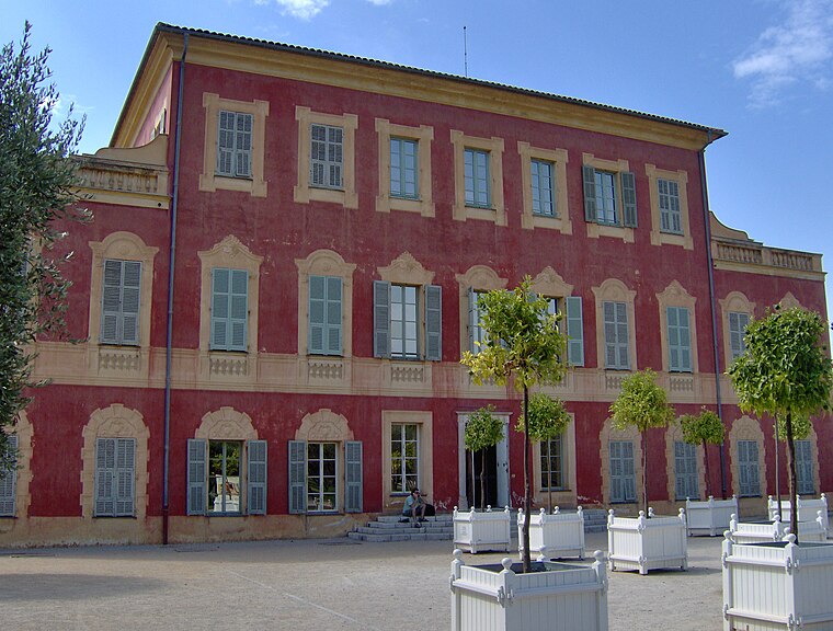
Photo: Tubantia, CC BY-SA 3.0.
The Musée Matisse in Nice is a municipal museum devoted to the work of French painter Henri Matisse. It gathers one of the world's largest collections of his works, tracing his artistic beginnings and his evolution through his last works. The Matisse Museum is situated 1¼ km southwest of Centre de secours principal Nice-Bon Voyage.
Places in the Area
Nearby places include Saint-André-de-la-Roche and L’Ariane.
Saint-André-de-la-Roche
Village

Photo: Jpchevreau, CC BY-SA 3.0.
Saint-André-de-la-Roche is a commune in the Alpes-Maritimes department in southeastern France. Until the 50s, in this small city there was a mountain with the shape of a shape-pyramid, similar to ancient pyramids from old civilizations.

Cimiez
Suburb
Cimiez is an upper-class neighborhood in Nice, Southern France. The area contains the Musée Matisse and the ruins of Cemenelum, capital of the Ancient Roman province Alpes Maritimae on the Ligurian coast.
Centre de secours principal Nice-Bon Voyage
Latitude
43.7276° or 43° 43′ 39″ northLongitude
7.28555° or 7° 17′ 8″ eastOpen location code
8FM9P7HP+26OpenStreetMap ID
way 1017348218OpenStreetMap feature
amenity=fire_station
This page is based on OpenStreetMap, Wikidata, and Wikimedia Commons.
We’d love your help improving our open data sources. Thank you for contributing.
Satellite Map
Discover Centre de secours principal Nice-Bon Voyage from above in high-definition satellite imagery.
Notable Places Nearby
Highlights include Église Saint-Pons and Bibliothèque Camille Claudel Pasteur.
Nearby Places
Explore places such as Parc à Fourrages and Parc à Fourrages.
Alpes-Maritimes: Must-Visit Destinations
Delve into Cannes, Antibes, Menton, and Grasse.
Curious Fire Stations to Discover
Uncover intriguing fire stations from every corner of the globe.
About Mapcarta. Data © OpenStreetMap contributors and available under the Open Database License". Text is available under the CC BY-SA 4.0 license, except for photos, directions, and the map. Photo: Michaelphillipr, CC BY-SA 3.0.