Lauta Forest
Lauta Forest is in Источен, Plovdiv. Lauta Forest is situated nearby to the climbing site Въжен парк Лаута, as well as near the university ТУ - София ф-л Пловдив.| Tap on a place to explore it |
Places of Interest Nearby
Highlights include Stadion Lokomotiv and Hristo Botev Stadium.
Stadion Lokomotiv
Stadium
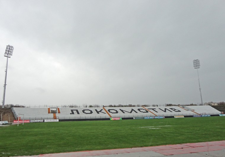
Photo: Realsteel007, CC BY-SA 3.0.
Stadion Lokomotiv, nicknamed Lauta after the park in which it is situated, is a multi-purpose stadium located in southeastern Plovdiv, Bulgaria. It is the club stadium of Lokomotiv Plovdiv. Stadion Lokomotiv is situated 1 km southwest of Lauta Forest.
Hristo Botev Stadium
Stadium

Photo: Wikimedia, CC BY-SA 4.0.
Stadion Hristo Botev is a football stadium in the Kamenitsa neighbourhood of Plovdiv, Bulgaria. It is the home of Botev Plovdiv. Originally named The College, it is still popular by this name amongst fans, as in the early 20th century the pitch was owned by Saint Augustine Catholic College. Hristo Botev Stadium is situated 1 km west of Lauta Forest.
Small Basilica
Museum

Photo: Realsteel007, CC BY-SA 3.0.
The Small Basilica of Philippopolis is one of Plovdiv's most distinctive landmarks. The basilica is located on Maria Louisa Blvd in the central part of Bulgaria's second-largest city. Small Basilica is situated 1½ km northwest of Lauta Forest.
Places in the Area
Nearby places include Kamenitsa and Stolipinovo.
Kamenitsa
Suburb
Kamenitsa is a residential neighbourhood in the east part of Plovdiv, in Bulgaria. It is famous for its local brewery, Kamenitza AD and football team of Botev Plovdiv.
Stolipinovo
Suburb
Stolipinovo is a district of the Bulgarian city of Plovdiv and the most populous predominantly Romani-inhabited district on the Balkans with a population of about 20,000 people.
Hadji Hassan Mahala
Suburb
Hadji Hassan Mahala is a Roma ghetto in Plovdiv, Bulgaria dating to 1400s. With a population of 8,000, residents generally regard themselves as being of the Turkish ethnicity.
Lauta Forest
- Type: Construction
- Location: Источен, Plovdiv, Bulgaria, Balkans, Europe
- View on OpenStreetMap
Latitude
42.14052° or 42° 8′ 26″ northLongitude
24.77657° or 24° 46′ 36″ eastOpen location code
8GJ64QRG+6JOpenStreetMap ID
way 1019674780OpenStreetMap feature
landuse=construction
This page is based on OpenStreetMap, Wikidata, and Wikimedia Commons.
We’d love your help improving our open data sources. Thank you for contributing.
Satellite Map
Discover Lauta Forest from above in high-definition satellite imagery.
Notable Places Nearby
Highlights include Въжен парк Лаута and ТУ - София ф-л Пловдив.
Nearby Places
Explore places such as Лаборатория по мерки и теглилки and Лаута.
Bulgaria: Must-Visit Destinations
Delve into Sofia, Veliko Tarnovo, Plovdiv, and Varna.
Curious Places to Discover
Uncover intriguing places from every corner of the globe.
About Mapcarta. Data © OpenStreetMap contributors and available under the Open Database License". Text is available under the CC BY-SA 4.0 license, except for photos, directions, and the map. Photo: Pamporoff, Public domain.