hkt
hkt is a factory in Linz, Upper Austria which is located on Eduard-Sueß-Straße. hkt is situated nearby to the sports venue Tennis Point, as well as near the shopping center Infra Center.| Tap on a place to explore it |
Places of Interest Nearby
Highlights include Johanneskirche (Linz) and St. Franziskus.
Johanneskirche (Linz)
Church
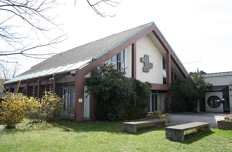
Photo: Wikimedia, CC BY-SA 3.0.
Johanneskirche (Linz) is a church, which is situated 730 metres east of hkt.
St. Franziskus
Church

Photo: Wikimedia, CC BY-SA 3.0.
St. Franziskus is a church, which is situated 1¼ km south of hkt.
Bundesrealgymnasium Landwiedstraße, Linz
School

Photo: Wikimedia, CC BY-SA 3.0.
Bundesrealgymnasium Landwiedstraße, Linz is a school, which is situated 1¼ km north of hkt.
Places in the Area
Nearby places include Leonding and Makartviertel.
Leonding
Town

Photo: Donald Judge, CC BY 2.0.
Leonding is a town southwest of Linz in the Austrian state of Upper Austria. It borders Puchenau and the river Danube in the north, Wilhering and Pasching in the west, Traun in the south and Linz in the east. Leonding is situated 3½ km northwest of hkt.
Makartviertel
Neighborhood

Photo: Lewenstein, CC BY-SA 3.0 at.
Makartviertel is a neighborhood, which is situated 4 km northeast of hkt.
Traun

Photo: JamesA, CC BY-SA 3.0.
Traun is an Austrian municipality located on the north bank of the river Traun and borders Linz, the capital of Upper Austria, to the east. The name Traun is derived from the Celtic word for river.
hkt
- Type: Factory
- Address: Eduard-Sueß-Straße 19a, Linz, 4020
- Categories: building and industry
- Location: Linz, Upper Austria, Austria, Central Europe, Europe
- View on OpenStreetMap
Latitude
48.25604° or 48° 15′ 22″ northLongitude
14.27859° or 14° 16′ 43″ eastOpen location code
8FWP774H+CCOpenStreetMap ID
way 102161652OpenStreetMap feature
building=yesOpenStreetMap feature
man_made=works
This page is based on OpenStreetMap, Wikidata, and Wikimedia Commons.
We’d love your help improving our open data sources. Thank you for contributing.
Satellite Map
Discover hkt from above in high-definition satellite imagery.
Places with the Same Name
Discover other places named “hkt”.
Notable Places Nearby
Highlights include Tennis Point and Infra Center.
Nearby Places
Explore places such as Neveon Lagerhalle and Neveon Schäumerei.
Upper Austria: Must-Visit Destinations
Delve into Hallstatt, Wels, Steyr, and Fugging.
Curious Factories to Discover
Uncover intriguing factories from every corner of the globe.
About Mapcarta. Data © OpenStreetMap contributors and available under the Open Database License". Text is available under the CC BY-SA 4.0 license, except for photos, directions, and the map. Photo: Rsuessrb, CC BY-SA 3.0.