Bunker Hill Elementary School Playground
Bunker Hill Elementary School Playground is a playground in Washington, D.C., Mid-Atlantic. Bunker Hill Elementary School Playground is situated nearby to Bunker Hill Elementary School Rain Garden, as well as near Michigan Park Christian Church.| Tap on a place to explore it |
Places of Interest Nearby
Highlights include Saint Anselm’s Abbey and Basilica of the National Shrine of the Immaculate Conception.
Saint Anselm’s Abbey
Church

Photo: Farragutful, CC BY-SA 4.0.
St. Anselm's Abbey is a Benedictine Abbey located at 4501 South Dakota Avenue, N.E, in Washington, D.C. It operates the boys' middle and high school St. Saint Anselm’s Abbey is situated 1,500 feet north of Bunker Hill Elementary School Playground.
Basilica of the National Shrine of the Immaculate Conception
Church

Photo: AgnosticPreachersKid, CC BY-SA 3.0.
The Basilica of the National Shrine of the Immaculate Conception is a Catholic minor basilica and national shrine in Washington D.C. It is the largest Catholic church building in North America and is also the tallest habitable building in Washington, D.C. Basilica of the National Shrine of the Immaculate Conception is situated 1 mile southwest of Bunker Hill Elementary School Playground.
Providence Hospital
Hospital
Providence Hospital was a 408-bed hospital located in the District of Columbia, United States. Founded in 1861 on Capitol Hill by the Roman Catholic Daughters of Charity of Saint Vincent de Paul, it was the longest continuously operating hospital and the last public hospital in the District. Providence Hospital is situated 2,800 feet west of Bunker Hill Elementary School Playground.
Places in the Area
Nearby places include Michigan Park and Brookland.
Michigan Park
Neighborhood
Michigan Park is a neighborhood in Ward 5 of Northeast Washington, D.C. in the Upper Northeast area element. The boundaries of Michigan Park and North Michigan Park neighborhoods are contested due to the history of racial disparity between the two, but…
Brookland
Suburb
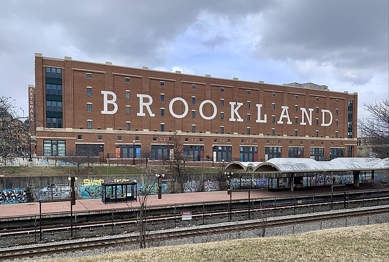
Photo: APK, CC BY-SA 4.0.
Brookland, Petworth, and Takoma are three relatively quiet neighborhoods east of Rock Creek Park. Following the "White Flight" after desegregation and the 1968 riots, these neighborhoods were left underpopulated, overwhelmingly African-American, and much less wealthy than the Upper Northwest, just across Rock Creek Park.
Avondale
Neighborhood
Avondale is an unincorporated community in Prince George's County Maryland, United States. It is contained between Eastern Avenue NE to the south, Queens Chapel Road to the east, and the Northwest Branch Anacostia River to the north and west.
Bunker Hill Elementary School Playground
- Type: Playground
- Category: recreation area
- Location: Washington, D.C., Mid-Atlantic, United States, North America
- View on OpenStreetMap
Latitude
38.94182° or 38° 56′ 31″ northLongitude
-76.98434° or 76° 59′ 4″ westOperator
Bunker Hill Elementary SchoolOpen location code
87C5W2R8+P7OpenStreetMap ID
way 1022142610OpenStreetMap feature
leisure=playground
This page is based on OpenStreetMap, Wikidata, and Wikimedia Commons.
We’d love your help improving our open data sources. Thank you for contributing.
Satellite Map
Discover Bunker Hill Elementary School Playground from above in high-definition satellite imagery.
Notable Places Nearby
Highlights include Bunker Hill Elementary School Rain Garden and Michigan Park Christian Church.
Nearby Places
Explore places such as Bunker Hill Elementary School and Michigan Ave NE at 16th St NE.
Washington, D.C.: Must-Visit Destinations
Delve into West End, Georgetown, East End, and Shaw.
Curious Playgrounds to Discover
Uncover intriguing playgrounds from every corner of the globe.
About Mapcarta. Data © OpenStreetMap contributors and available under the Open Database License". Text is available under the CC BY-SA 4.0 license, except for photos, directions, and the map. Photo: Peterfitzgerald, CC BY-SA 3.0.