Pylote
Pylote is a building in Lyon, Greater Lyon, Auvergne-Rhône-Alpes. Pylote is situated nearby to the college Euridis Business School, as well as near Place Hubert Mounier.| Tap on a place to explore it |
Places of Interest Nearby
Highlights include Gare de Lyon-Perrache and Musée des géomètres-experts de la région Auvergne-Rhône-Alpes.
Gare de Lyon-Perrache
Railway station
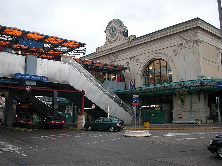
Photo: Pymouss44, CC BY-SA 3.0.
Lyon–Perrache or simply Perrache is a large railway station located in the Perrache quarter, in the 2nd arrondissement of Lyon, France. Historically the primary railway station in Lyon, today it is the city's second-busiest station, after the newer Lyon-Part-Dieu station. Gare de Lyon-Perrache is situated 1 km north of Pylote.
Musée des géomètres-experts de la région Auvergne-Rhône-Alpes
Museum

Photo: Romainbehar, CC0.
Musée des géomètres-experts de la région Auvergne-Rhône-Alpes is a museum, which is situated 270 metres northwest of Pylote.
Patinoire Charlemagne
Ice rink
 The Patinoire Charlemagne is an ice rink in Lyon, France, located in the Confluence quarter, in the 2nd arrondissement of Lyon. It hosts many international competitions, such as the European Championships of figure skating, and entertainments and is reserved for various sports including figure skating, hockey, and curling. Patinoire Charlemagne is situated 340 metres northwest of Pylote.
Places in the Area
Nearby places include La Confluence and 7th arrondissement of Lyon.

7th arrondissement of Lyon
Suburb
 The 7th arrondissement of Lyon is one of the nine arrondissements of the City of Lyon.
2nd arrondissement of Lyon
Suburb

Photo: Romainbehar, CC0.
The 2nd arrondissement of Lyon is one of the nine arrondissements of the City of Lyon.
Pylote
- Type: Building
- Postal code: 69002
- Location: Lyon, Arrondissement of Lyon, Greater Lyon, Auvergne-Rhône-Alpes, France, Europe
- View on OpenStreetMap
Latitude
45.74106° or 45° 44′ 28″ northLongitude
4.8236° or 4° 49′ 25″ eastLevels
7Open location code
8FQ6PRRF+CCOpenStreetMap ID
way 1024197232OpenStreetMap feature
building=yes
This page is based on OpenStreetMap, Wikidata, and Wikimedia Commons.
We’d love your help improving our open data sources. Thank you for contributing.
Satellite Map
Discover Pylote from above in high-definition satellite imagery.
Notable Places Nearby
Highlights include Euridis Business School and Place Hubert Mounier.
Nearby Places
Explore places such as Sollys and Sens‘.
Greater Lyon: Must-Visit Destinations
Delve into Saint-Étienne, Roanne, Villefranche-sur-Saône, and Divonne-les-Bains.
Curious Buildings to Discover
Uncover intriguing buildings from every corner of the globe.
About Mapcarta. Data © OpenStreetMap contributors and available under the Open Database License". Text is available under the CC BY-SA 4.0 license, except for photos, directions, and the map. Photo: Fabimaru, CC0.