Donald W. Reynolds Recreation Center
Donald W. Reynolds Recreation Center is a community center in Garvin, Oklahoma which is located on North Willow Street. Donald W. Reynolds Recreation Center is situated nearby to Pauls Valley Water Park, as well as near Wacker Park.| Tap on a place to explore it |
Places of Interest Nearby
Highlights include Pauls Valley station.
Pauls Valley station
Railway station

Photo: Railfan3145, CC BY-SA 4.0.
Pauls Valley is an Amtrak station in Pauls Valley, Oklahoma. The station is serviced by the daily Heartland Flyer, which travels from Oklahoma City, Oklahoma to Fort Worth, Texas. Pauls Valley station is situated 4,200 feet southeast of Donald W. Reynolds Recreation Center.
Places in the Area
Nearby places include Pauls Valley and Paoli.
Pauls Valley
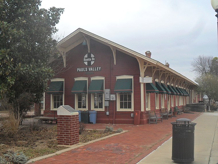
Photo: Railfan3145, CC BY-SA 4.0.
Pauls Valley is a city in and the county seat of Garvin County, Oklahoma, United States. The population was 5,992 at the 2020 census, a decline of 3.2 percent from the figure of 6,187 in 2010.
Paoli
Village
Paoli is a town in Garvin County, Oklahoma, United States. The population was 610 at the 2010 census. It was named after Paoli, Pennsylvania, an unincorporated community near Philadelphia from which many of the railroad workers who built the town came. Paoli is situated 6 miles north of Donald W. Reynolds Recreation Center.
Donald W. Reynolds Recreation Center
- Type: Community center
- Address: 1005 North Willow Street, Pauls Valley, OK 73075
- Category: building
- Location: Garvin, Oklahoma, Great Plains, United States, North America
- View on OpenStreetMap
Latitude
34.74765° or 34° 44′ 52″ northLongitude
-97.23027° or 97° 13′ 49″ westOpen location code
8664PQX9+3VOpenStreetMap ID
way 1026621551OpenStreetMap feature
amenity=community_centreOpenStreetMap feature
building=yes
This page is based on OpenStreetMap, Wikidata, and Wikimedia Commons.
We’d love your help improving our open data sources. Thank you for contributing.
Satellite Map
Discover Donald W. Reynolds Recreation Center from above in high-definition satellite imagery.
Notable Places Nearby
Highlights include Pauls Valley Water Park and Wacker Park.
Nearby Places
Explore places such as Lee School and Garvin County Courthouse.
Oklahoma: Must-Visit Destinations
Delve into Oklahoma City, Tulsa, Norman, and Lawton.
Curious Community Centers to Discover
Uncover intriguing community centers from every corner of the globe.
About Mapcarta. Data © OpenStreetMap contributors and available under the Open Database License". Text is available under the CC BY-SA 4.0 license, except for photos, directions, and the map. Photo: Wikimedia, CC0.