centro de educación inicil luis mariano rivera
centro de educación inicil luis mariano rivera is a school in Juan Antonio Sotillo Municipality, Anzoátegui. centro de educación inicil luis mariano rivera is situated nearby to the grassland Franja de protección del poliducto de Sisor, as well as near the university Aldea universitaria Antonio José de Sucre.| Tap on a place to explore it |
Places of Interest Nearby
Highlights include Estadio Alfonso Chico Carrasquel and Iglesia de la Santa Cruz.
Estadio Alfonso Chico Carrasquel
Stadium

Photo: Isamu99, CC BY-SA 3.0.
Estadio Alfonso Chico Carrasquel is a baseball stadium based in Puerto la Cruz, Venezuela, which serves as home for the Caribes de Anzoátegui of the Venezuelan Professional Baseball League. Estadio Alfonso Chico Carrasquel is situated 1 km southwest of centro de educación inicil luis mariano rivera.
Iglesia de la Santa Cruz
Church
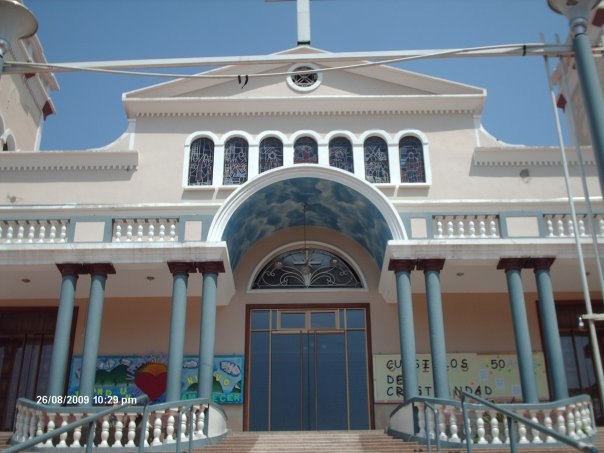
Photo: Veronidae, CC BY-SA 3.0.
Iglesia de la Santa Cruz is a church, which is situated 1½ km northwest of centro de educación inicil luis mariano rivera.
Puerto la Cruz refinery

Photo: DaniZam, CC BY-SA 3.0.
Puerto la Cruz refinery is situated 1 km northeast of centro de educación inicil luis mariano rivera.
Places in the Area
Nearby places include Puerto La Cruz.
Puerto La Cruz
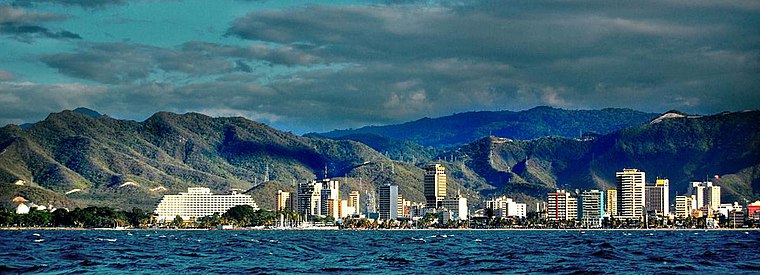
Photo: Hiddendaemian, CC BY 2.0.
Puerto La Cruz is a city in Venezuela's Northeast, in the state of Anzoátegui. In some ways, it's kind of like the beachside resort area for Barcelona nearby, although it is tainted a bit by the fact that it's also the home of the Puerto La Cruz refinery, one of the largest in the country, along with a fossil fuel processing plant.
centro de educación inicil luis mariano rivera
- Type: School
- Address: Puerto La Cruz
- Category: education
- Location: Juan Antonio Sotillo Municipality, Anzoátegui, Venezuela, South America
- View on OpenStreetMap
Latitude
10.21281° or 10° 12′ 46″ northLongitude
-64.62591° or 64° 37′ 33″ westOpen location code
772Q697F+4JOpenStreetMap ID
way 1027452252OpenStreetMap feature
amenity=school
This page is based on OpenStreetMap, Wikidata, and Wikimedia Commons.
We’d love your help improving our open data sources. Thank you for contributing.
Satellite Map
Discover centro de educación inicil luis mariano rivera from above in high-definition satellite imagery.
Notable Places Nearby
Highlights include Franja de protección del poliducto de Sisor and Aldea universitaria Antonio José de Sucre.
Nearby Places
Explore places such as Cied (PDVSA) and arese motors.
Venezuela: Must-Visit Destinations
Delve into Caracas, Mérida, Maracaibo, and Táchira.
Curious Schools to Discover
Uncover intriguing schools from every corner of the globe.
About Mapcarta. Data © OpenStreetMap contributors and available under the Open Database License". Text is available under the CC BY-SA 4.0 license, except for photos, directions, and the map. Photo: Rjcastillo, CC BY-SA 3.0.