zahr. osada Úsvit
zahr. osada Úsvit is an allotment garden in Krnov, Bruntál District, Moravian-Silesian Region. zahr. osada Úsvit is situated nearby to the public building vrátnice, as well as near the swimming pool Městské koupaliště.| Tap on a place to explore it |
Places of Interest Nearby
Highlights include Krnov Castle and Krnov (train station).
Krnov Castle

Photo: Herbert Ortner, CC BY 2.5.
Krnov Castle is situated 1¼ km southeast of zahr. osada Úsvit.
Krnov (train station)
Railway station
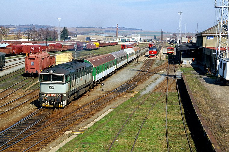
Photo: Herbert Ortner, CC BY 2.5.
Krnov (train station) is a railway station, which is situated 1 km southwest of zahr. osada Úsvit.
Church of the Exaltation of the Holy Cross
Church
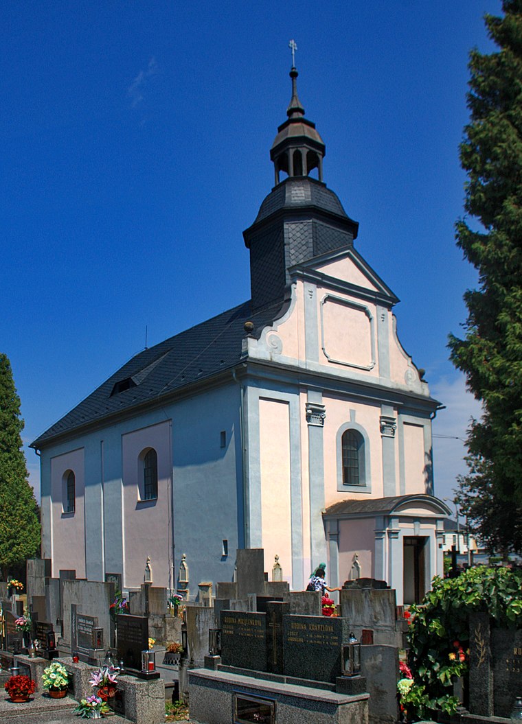
Photo: Wikimedia, CC BY-SA 4.0.
Church of the Exaltation of the Holy Cross is situated 1 km southeast of zahr. osada Úsvit.
Places in the Area
Nearby places include Krnov and Chomiąża.
Krnov
Town

Photo: Herbert Ortner, CC BY 2.5.
Krnov is a town in Bruntál District in the Moravian-Silesian Region of the Czech Republic. It has about 23,000 inhabitants. The town is known for the production of the cola-based drink Kofola.
Chomiąża
Village

Photo: Sicherlich, CC BY 3.0.
Chomiąża is a village located in Poland, in the Opole Voivodeship, Głubczyce County and Gmina Głubczyce.
Ciermięcice
Village

Photo: Sicherlich, CC BY 3.0.
Ciermięcice is a village located in Poland, in the Opole Voivodeship, Głubczyce County and Gmina Głubczyce. Potok Ciermięcicki, the left tributary of the Opava river, flows through the village.
zahr. osada Úsvit
Latitude
50.09756° or 50° 5′ 51″ northLongitude
17.69164° or 17° 41′ 30″ eastOpen location code
9F2V3MXR+2MOpenStreetMap ID
way 102762546OpenStreetMap feature
landuse=allotments
This page is based on OpenStreetMap, Wikidata, and Wikimedia Commons.
We’d love your help improving our open data sources. Thank you for contributing.
Satellite Map
Discover zahr. osada Úsvit from above in high-definition satellite imagery.
Notable Places Nearby
Highlights include vrátnice and Městské koupaliště.
Nearby Places
Explore places such as zahrádkářská osada Zlatá Opavice and Mateřská škola Jiráskova.
Czech Republic: Must-Visit Destinations
Delve into Prague, Brno, Pilsen, and Ostrava.
Curious Allotment Gardens to Discover
Uncover intriguing allotment gardens from every corner of the globe.
About Mapcarta. Data © OpenStreetMap contributors and available under the Open Database License". Text is available under the CC BY-SA 4.0 license, except for photos, directions, and the map. Photo: john mcsporran, CC BY 2.0.