Okura Elementary School
Okura Elementary School is a school in Katori, Chiba. Okura Elementary School is situated nearby to the police station Police Box, as well as near the community center 代下公会堂.| Tap on a place to explore it |
Places of Interest Nearby
Highlights include Suigō Station and Katori Station.
Suigō Station
Railway station

Photo: Mister0124, CC BY-SA 4.0.
Suigō Station a passenger railway station in the city of Katori, Chiba Japan, operated by the East Japan Railway Company. Suigō Station is situated 580 metres southeast of Okura Elementary School.
Katori Station
Railway station
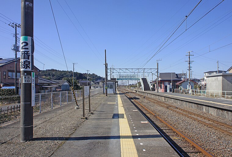
Photo: Mister0124, CC BY-SA 4.0.
Katori Station a junction passenger railway station in the city of Katori, Chiba Japan, operated by the East Japan Railway Company. Katori Station is situated 3 km west of Okura Elementary School.
Katori Shrine
Shinto shrine

Photo: Saigen Jiro, CC0.
The Katori Shrine is a Shintō shrine in the city of Katori in Chiba Prefecture, Japan. It is the ichinomiya of former Shimōsa Province, and is the head shrine of the approximately 400 Katori shrines around the country. Katori Shrine is situated 3½ km west of Okura Elementary School.
Okura Elementary School
Latitude
35.89078° or 35° 53′ 27″ northLongitude
140.5667° or 140° 34′ 0″ eastOpen location code
8R72VHR8+8MOpenStreetMap ID
way 1028609532OpenStreetMap feature
amenity=school
This page is based on OpenStreetMap, Wikidata, and Wikimedia Commons.
We’d love your help improving our open data sources. Thank you for contributing.
Satellite Map
Discover Okura Elementary School from above in high-definition satellite imagery.
Notable Places Nearby
Highlights include Police Box and 代下公会堂.
Nearby Places
Explore places such as Okura Nursery and 大倉小学校.
Chiba: Must-Visit Destinations
Delve into Chiba, Narita International Airport, Funabashi, and Kashiwa.
Curious Schools to Discover
Uncover intriguing schools from every corner of the globe.
About Mapcarta. Data © OpenStreetMap contributors and available under the Open Database License". Text is available under the CC BY-SA 4.0 license, except for photos, directions, and the map. Photo: Nicolas1981, CC BY-SA 3.0.