Hauptschule Wichlinghausen
Hauptschule Wichlinghausen is a school in Wuppertal, Düsseldorf, North Rhine-Westphalia. Hauptschule Wichlinghausen is situated nearby to the park Walter-Posth-Platz, as well as near Belvedere.| Tap on a place to explore it |
Places of Interest Nearby
Highlights include Immanuelskirche and Wichlinghauser Kirche.
Immanuelskirche
Arts center

Photo: Wikimedia, Public domain.
Immanuelskirche is an arts center, which is situated 360 metres south of Hauptschule Wichlinghausen.
Wichlinghauser Kirche
Church
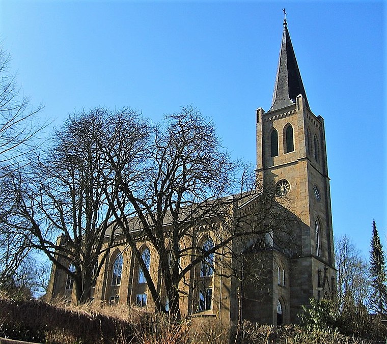
Photo: Pitichinaccio, Public domain.
Wichlinghauser Kirche is a church, which is situated 350 metres north of Hauptschule Wichlinghausen.
Carl-Duisberg-Gymnasium

Photo: Jossi, CC BY-SA 3.0.
Carl-Duisberg-Gymnasium is situated 450 metres east of Hauptschule Wichlinghausen.
Places in the Area
Nearby places include Barmen and Langerfeld.
Barmen
Suburb

Photo: Manos, CC BY-SA 3.0.
Barmen is a former industrial metropolis of the region of Bergisches Land, Germany, which merged with four other towns in 1929 to form the city of Wuppertal.
Langerfeld
Suburb

Photo: A.Savin, CC BY-SA 3.0.
Langerfeld is a borough of the German city of Wuppertal. On 24 June 2018, an explosion in the area damaged an apartment complex and surroundings. The blast was powerful and destroyed the three top floors of the block and a parked car.
Nächstebreck
Suburb

Photo: Pitichinaccio, Public domain.
Nächstebreck is a suburb, which is situated 4 km northeast of Hauptschule Wichlinghausen.
Hauptschule Wichlinghausen
- Type: School
- Category: education
- Location: Wuppertal, Düsseldorf, Bergisches Land, North Rhine-Westphalia, Germany, Central Europe, Europe
- View on OpenStreetMap
Latitude
51.2791° or 51° 16′ 45″ northLongitude
7.21473° or 7° 12′ 53″ eastOperator
WuppertalOpen location code
9F3976H7+JVOpenStreetMap ID
way 1031455074OpenStreetMap feature
amenity=schoolOpenStreetMap feature
landuse=education
This page is based on OpenStreetMap, Wikidata, and Wikimedia Commons.
We’d love your help improving our open data sources. Thank you for contributing.
Satellite Map
Discover Hauptschule Wichlinghausen from above in high-definition satellite imagery.
Notable Places Nearby
Highlights include Walter-Posth-Platz and Belvedere.
Nearby Places
Explore places such as Städtische Grundschule Matthäusstraße and Städtische Tageseinrichtung für Kinder.
Bergisches Land: Must-Visit Destinations
Delve into Solingen, Bergisch Gladbach, Remscheid, and Gummersbach.
Curious Schools to Discover
Uncover intriguing schools from every corner of the globe.
About Mapcarta. Data © OpenStreetMap contributors and available under the Open Database License". Text is available under the CC BY-SA 4.0 license, except for photos, directions, and the map. Photo: Wikimedia, CC0.