Gellerup Plantage
Gellerup Plantage is a forest in Varde Municipality, Region of Southern Denmark. Gellerup Plantage is situated nearby to the suburb Bellevue, as well as near Østermarken.| Tap on a place to explore it |
Places of Interest
Highlights include Varde railway station and Varde Miniby.
Varde railway station
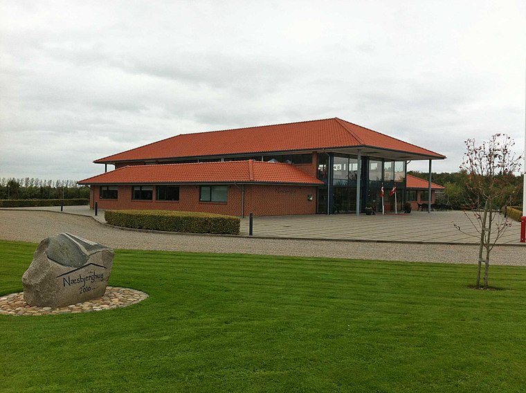
Railway station
 Varde railway station is the main railway station serving the market town of Varde in West Jutland, Denmark. It is located in central Varde, immediately adjacent to the Varde bus station.


Places in the Area
Nearby places include Varde and Næsbjerg.
Varde

Photo: Taxiarchos228, FAL.
Varde is a town in West Jutland. The municipality is the largest coastal tourism municipality in Denmark and especially attracts tourists to the coastal destinations of Blåvand, Vejers Strand and Henne Strand.

Gellerup Plantage
- Type: Forest
- Location: Varde Municipality, Region of Southern Denmark, Denmark, Nordic countries, Europe
- View on OpenStreetMap
Latitude
55.6185° or 55° 37′ 7″ northLongitude
8.5209° or 8° 31′ 15″ eastOpen location code
9F7CJG9C+99OpenStreetMap ID
way 103300818OpenStreetMap feature
landuse=forest
This page is based on OpenStreetMap, Wikidata, and Wikimedia Commons.
We’d love your help improving our open data sources. Thank you for contributing.
Satellite Map
Discover Gellerup Plantage from above in high-definition satellite imagery.
Places with the Same Name
Discover other places named “Gellerup Plantage”.
Localities in the Area
Explore places such as Gellerup and Bellevue.
Notable Places Nearby
Highlights include Tophøj and Færdselsstyrelsen - Prøvested.
Denmark: Must-Visit Destinations
Delve into Copenhagen, Aarhus, Odense, and Aalborg.
Curious Forests to Discover
Uncover intriguing forests from every corner of the globe.
About Mapcarta. Data © OpenStreetMap contributors and available under the Open Database License". Text is available under the CC BY-SA 4.0 license, except for photos, directions, and the map. Photo: Wikimedia, CC BY-SA 3.0.