Blue Ridge Pregnancy Center
Blue Ridge Pregnancy Center is a clinic in Lynchburg, Central Virginia, Virginia which is located on Thomson Drive. Blue Ridge Pregnancy Center is situated nearby to Lynchburg General Hospital, as well as near the helipad L. G. Hospital heliport.| Tap on a place to explore it |
- Opening hours:
Monday—Wednesday: 10:30 AM—5:00 PM
Thursday: 12:30 PM—7:00 PM - Type: Clinic
- Address: 1915 Thomson Drive, Lynchburg, VA 24501
Places of Interest Nearby
Highlights include Centerview and Kemper Street station.
Centerview
Historic building

Photo: Pubdog, Public domain.
Centerview is a historic home located at Lynchburg, Virginia. It is a two-story brick house completed in 1871 in the Greek Revival style. The dependency, which is similar in construction and detail to the main house but which may date to 1861, is a one-stay gabled brick building and originally served as a summer kitchen and cook's dwelling among other functions. Centerview is situated 1 mile southeast of Blue Ridge Pregnancy Center.
Kemper Street station
Railway station

Photo: TampAGS, CC BY-SA 3.0.
Kemper Street station, also known as Lynchburg station, is an intermodal transit station in Lynchburg, Virginia, United States. It serves Amtrak while an adjacent bus transfer center serves Greater Lynchburg Transit Company and Greyhound buses. Kemper Street station is situated 1¼ miles southeast of Blue Ridge Pregnancy Center.
Aviary
Historic building

Photo: Pubdog, Public domain.
The Aviary is a historic aviary building located in Miller Park at Lynchburg, Virginia. It is a Queen Anne-style structure erected in 1902. The multi-sided exhibition house was designed by the local architectural firm of Frye & Chesterman. Aviary is situated 1¼ miles southeast of Blue Ridge Pregnancy Center.
Places in the Area
Nearby places include Kemper Street Industrial Historic District and Diamond Hill Historic District.
Kemper Street Industrial Historic District
Neighborhood
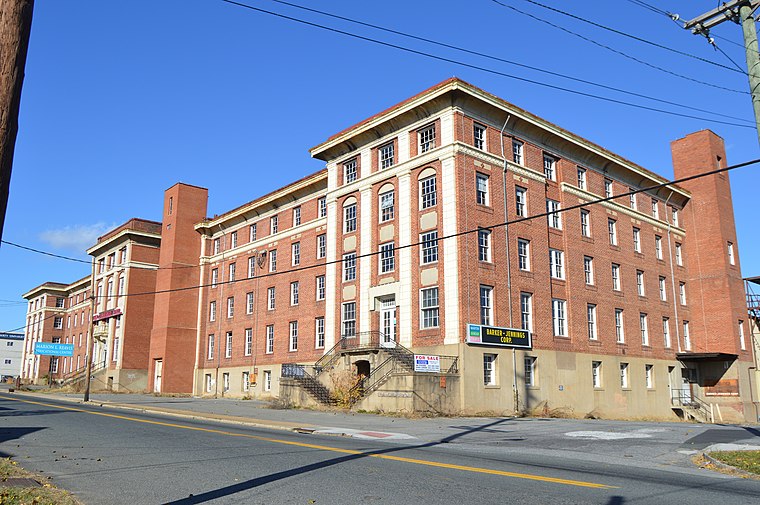
Photo: Nyttend, Public domain.
The Kemper Street Industrial Historic District encompasses a collection of industrial sites on Campbell Avenue and Kemper Street in Lynchburg, Virginia.
Diamond Hill Historic District
Neighborhood

Photo: Pubdog, Public domain.
The Diamond Hill Historic District is a national historic district located in Lynchburg, Virginia. The district is irregularly shaped and approximately 14 blocks in area. Diamond Hill Historic District is situated 2 miles east of Blue Ridge Pregnancy Center.
Madison Heights
Town

Photo: Carmenshields, CC BY 3.0.
Madison Heights is a census-designated place in Amherst County, Virginia, United States. The population was 10,893 at the 2020 census. It is part of the Lynchburg Metropolitan Statistical Area. Madison Heights is situated 3 miles east of Blue Ridge Pregnancy Center.
Blue Ridge Pregnancy Center
- Categories: health care, building, and commercial building
- Location: Lynchburg, Central Virginia, Virginia, South, United States, North America
- View on OpenStreetMap
Latitude
37.41741° or 37° 25′ 3″ northLongitude
-79.17468° or 79° 10′ 29″ westOpen location code
8792CR8G+X4OpenStreetMap ID
way 1033577035OpenStreetMap feature
amenity=clinicOpenStreetMap feature
building=commercialOpenStreetMap feature
healthcare=clinic
This page is based on OpenStreetMap, Wikidata, and Wikimedia Commons.
We’d love your help improving our open data sources. Thank you for contributing.
Satellite Map
Discover Blue Ridge Pregnancy Center from above in high-definition satellite imagery.
Notable Places Nearby
Highlights include Lynchburg General Hospital and L. G. Hospital heliport.
Nearby Places
Explore places such as Centra Medical Group Surgical Specialists and Black Locust - robina pseudoacacia.
Central Virginia: Must-Visit Destinations
Delve into Richmond, Charlottesville, Petersburg, and Danville.
Curious Clinics to Discover
Uncover intriguing clinics from every corner of the globe.
About Mapcarta. Data © OpenStreetMap contributors and available under the Open Database License". Text is available under the CC BY-SA 4.0 license, except for photos, directions, and the map. Photo: Wikimedia, CC0.