Westbrook Little League Concession Stand
Westbrook Little League Concession Stand is a building in Westbrook, Lower Connecticut River Valley Planning Region, Connecticut. Westbrook Little League Concession Stand is situated nearby to the pitch Ted Lane Field, as well as near the fire station Westbrook Chemical Engine Co. #1.| Tap on a place to explore it |
Places of Interest Nearby
Highlights include Westbrook station and Salt Island.
Westbrook station
Railway station
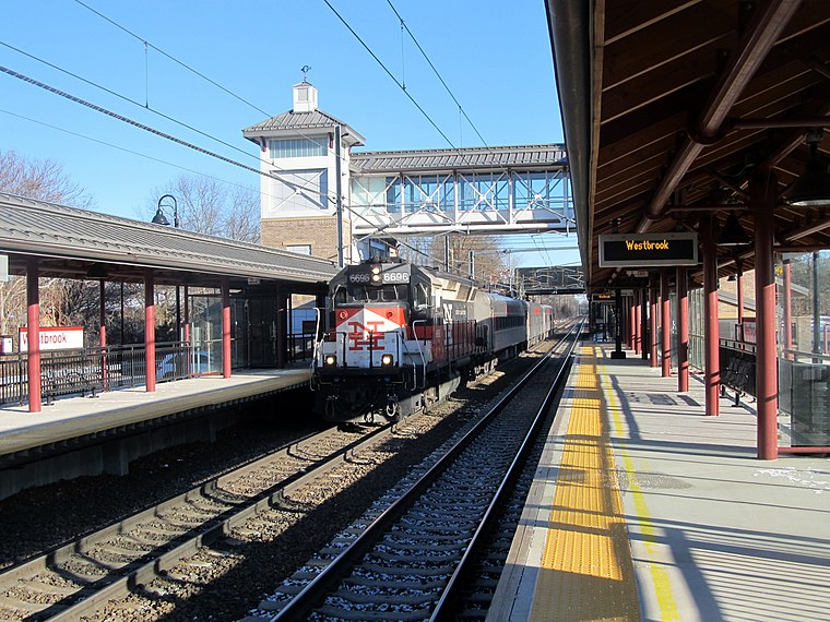
Photo: Pi.1415926535, CC BY-SA 3.0.
Westbrook station is a regional rail station on the Northeast Corridor, located off Connecticut Route 153 just north of the village center of Westbrook, Connecticut. Westbrook station is situated 1,500 feet north of Westbrook Little League Concession Stand.
Salt Island
Island
Salt Island is an island off the coast of Westbrook, Middlesex County, in the U.S. state of Connecticut. The island is very easy to get to from the Westbrook public beaches, as it is only 500 feet away from land.
Westbrook High School
School
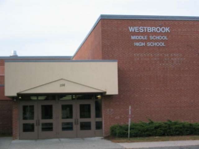
Photo: Compbrain, Public domain.
Westbrook High School is a U.S. public high school located in Westbrook, Connecticut. The school serves grades 9 through 12, and usually enrolls between 150 and 250 students each year. Westbrook High School is situated 1 mile north of Westbrook Little League Concession Stand.
Places in the Area
Nearby places include Westbrook and Old Saybrook.
Westbrook
Town

Photo: Pi.1415926535, CC BY-SA 3.0.
Westbrook is a town in Middlesex County, Connecticut, United States. The town is part of the Lower Connecticut River Valley Planning Region. The population was 6,769 at the 2020 census.
Old Saybrook

Photo: Juliejules, CC BY 3.0.
Old Saybrook is a city of 10,000 people in Connecticut at the mouth of the Connecticut River. Families and tourists enjoy Old Saybrook's beaches, the high quality of restaurants, and the peaceful and serene atmosphere.
Clinton

Photo: Jeff Bellinger, CC BY-SA 3.0.
Clinton is a Connecticut center shoreline town between the Greater New Haven and Connecticut River Valley regions.
Westbrook Little League Concession Stand
Latitude
41.28495° or 41° 17′ 6″ northLongitude
-72.44995° or 72° 26′ 60″ westInception
April 1992Open location code
87H97HM2+X2OpenStreetMap ID
way 1049772100OpenStreetMap feature
building=yes
This page is based on OpenStreetMap, Wikidata, and Wikimedia Commons.
We’d love your help improving our open data sources. Thank you for contributing.
Satellite Map
Discover Westbrook Little League Concession Stand from above in high-definition satellite imagery.
Notable Places Nearby
Highlights include Ted Lane Field and Westbrook Chemical Engine Co. #1.
Nearby Places
Explore places such as Home and Visitor.
Connecticut: Must-Visit Destinations
Delve into Hartford, New Haven, Bridgeport, and Stamford.
Curious Buildings to Discover
Uncover intriguing buildings from every corner of the globe.
About Mapcarta. Data © OpenStreetMap contributors and available under the Open Database License". Text is available under the CC BY-SA 4.0 license, except for photos, directions, and the map. Photo: Wikimedia, CC0.