Kemel Cartons
Kemel Cartons is a building in Manitoba, Prairies which is located on Partridge Avenue. Kemel Cartons is situated nearby to the playground Newton Tot Lot, as well as near Shaarey Zedek Cemetery.| Tap on a place to explore it |
Places of Interest Nearby
Highlights include Shaarey Zedek Cemetery and Kildonan Park.
Shaarey Zedek Cemetery
Cemetery
Shaarey Zedek Cemetery is a Conservative Jewish burial ground in the North End of Winnipeg, Manitoba, Canada. Operated by the Shaarey Zedek Synagogue, it is the largest Jewish cemetery in the Canadian Prairies, with more than 8,000 graves as of 1996. Shaarey Zedek Cemetery is situated 410 metres northeast of Kemel Cartons.
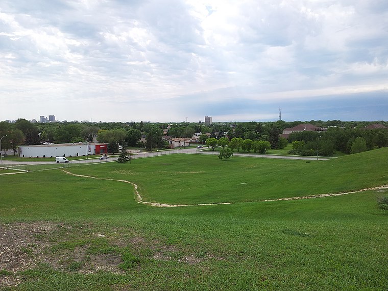
Kildonan Park
Park

Photo: Jimj wpg, CC BY-SA 4.0.
Kildonan Park is a park in the West Kildonan area of northern Winnipeg, Manitoba, Canada. Established in 1909 as a 73-acre park, it features the Peguis Pavilion, Rainbow Stage, the Witch's Hut, an Olympic-sized outdoor swimming pool, duck pond, and soccer field as well as picnic tables and barbecue pits. Kildonan Park is situated 1 km east of Kemel Cartons.
Seven Oaks House Museum
Museum

Photo: Stan Kucera, CC BY-SA 4.0.
The Seven Oaks House Museum is a civic museum in Winnipeg, Manitoba. The two-storey log dwelling is designated a Provincial Heritage Site, and a Winnipeg Landmark Heritage Structure. Seven Oaks House Museum is situated 1¼ km south of Kemel Cartons.
Places in the Area
Nearby places include Garden City and North End.
Garden City
Neighborhood
Garden City is a suburban neighbourhood in Winnipeg, Manitoba. The area features large homes and residential lots, numerous parks and schools, and includes Garden City Shopping Centre, a regional mall.
North End
Suburb

Photo: Daver112, Public domain.
Winnipeg's North End is a large urban area located to the north and northwest of Downtown Winnipeg. It is bordered by the Red River on the east, the Canadian Pacific Railway mainline on the south, the City of Winnipeg boundary on the west and Jefferson Avenue, Keewatin Street, Carruthers Avenue, McGregor Street and the lane between McAdam and Smithfield Avenues on the north. North End is situated 3 km southwest of Kemel Cartons.
East Kildonan
Suburb
 East Kildonan is a primarily residential community in northeast Winnipeg, Manitoba, Canada. Commonly known by its initials EK, the suburb has a population of approximately 35,800 as of the 2016 Census. East Kildonan is situated 3 km southeast of Kemel Cartons.
Kemel Cartons
- Type: Commercial building
- Address: 270 Partridge Avenue
- Categories: building and office
- Location: Manitoba, Prairies, Canada, North America
- View on OpenStreetMap
Latitude
49.94256° or 49° 56′ 33″ northLongitude
-97.11821° or 97° 7′ 6″ westOpen location code
86X4WVVJ+2POpenStreetMap ID
way 1052115938OpenStreetMap feature
building=commercial
This page is based on OpenStreetMap, Wikidata, and Wikimedia Commons.
We’d love your help improving our open data sources. Thank you for contributing.
Satellite Map
Discover Kemel Cartons from above in high-definition satellite imagery.
Notable Places Nearby
Highlights include Newton Tot Lot and Weinberg Tot Lot.
Nearby Places
Explore places such as Eastbound Partridge at Aikins and Northbound Salter at Partridge.
Manitoba: Must-Visit Destinations
Delve into Winnipeg, Churchill, Brandon, and Thompson.
Curious Places to Discover
Uncover intriguing places from every corner of the globe.
About Mapcarta. Data © OpenStreetMap contributors and available under the Open Database License". Text is available under the CC BY-SA 4.0 license, except for photos, directions, and the map. Photo: Wikimedia, CC0.