Tanzsportclub Rubin
Tanzsportclub Rubin is a sports venue in Saarland, Germany which is located on St.Nazairer Allee. Tanzsportclub Rubin is situated nearby to the sports venue Rocklands Saarlouis, as well as near the motorhome stopover Wohnmobilstellplatz In den Fliesen - Saarlouis.| Tap on a place to explore it |
Places of Interest Nearby
Highlights include Katerturm and Gustav-Heinemann-Brücke.
Katerturm

Photo: Xocolatl, Public domain.
Katerturm is situated 400 metres southeast of Tanzsportclub Rubin.
Gustav-Heinemann-Brücke
Bridge

Photo: FlocciNivis, CC BY 4.0.
Gustav-Heinemann-Brücke is a bridge, which is situated 510 metres east of Tanzsportclub Rubin.
Rathaus Saarlouis
Town hall
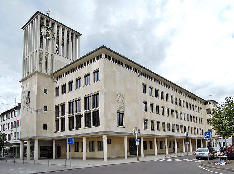
Photo: LoKiLeCh, CC BY-SA 3.0.
Rathaus Saarlouis is a town hall, which is situated 1 km southeast of Tanzsportclub Rubin.
Places in the Area
Nearby places include Saarlouis and Beaumarais.
Saarlouis
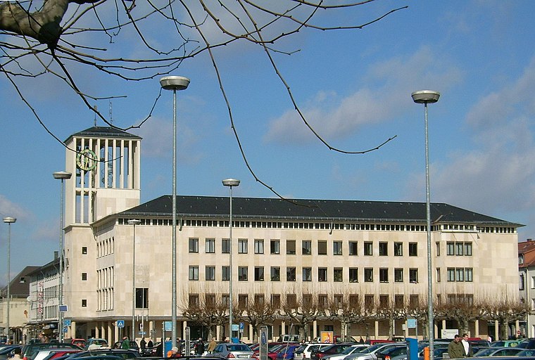
Photo: Kolling, CC BY-SA 3.0.
Saarlouis is a city and district in Saarland. With close to 200,000 inhabitants, it is the second most populous district in Saarland after neighbouring Saarbrücken, though only about 35,000 live in the city of Saarlouis itself.

Wallerfangen
Village

Photo: Kolling, CC BY-SA 3.0.
Wallerfangen is a municipality of Saarlouis district, Saarland, Germany. Located west of Saarlouis and along the French border, it is the seat of the villages of Ittersdorf, Ihn, Leidingen, St.
Tanzsportclub Rubin
- Type: Sports venue
- Address: St.Nazairer Allee 8a, Saarlouis, 66740
- Categories: building, recreation area, and sports location
- Location: Saarland, Germany, Central Europe, Europe
- View on OpenStreetMap
Latitude
49.32199° or 49° 19′ 19″ northLongitude
6.74067° or 6° 44′ 26″ eastOpen location code
8FX88PCR+Q7OpenStreetMap ID
way 105212303OpenStreetMap feature
building=yesOpenStreetMap feature
leisure=sports_centreOpenStreetMap feature
sport=Tanzsport
This page is based on OpenStreetMap, Wikidata, and Wikimedia Commons.
We’d love your help improving our open data sources. Thank you for contributing.
Satellite Map
Discover Tanzsportclub Rubin from above in high-definition satellite imagery.
Notable Places Nearby
Highlights include Rocklands Saarlouis and Wohnmobilstellplatz In den Fliesen - Saarlouis.
Nearby Places
Explore places such as Bistro Basecamp and Clubheim SSV / Hornets.
Saarland: Must-Visit Destinations
Delve into Saarbrücken, Saarlouis, Homburg, and Merzig.
Curious Sports Venues to Discover
Uncover intriguing sports venues from every corner of the globe.
About Mapcarta. Data © OpenStreetMap contributors and available under the Open Database License". Text is available under the CC BY-SA 4.0 license, except for photos, directions, and the map. Photo: wolfgangstaudt, CC BY 2.0.