Jersey Explorer Children’s Museum
Jersey Explorer Children’s Museum is a museum in City of East Orange, Essex County, New Jersey which is located on Dodd Street. Jersey Explorer Children’s Museum is situated nearby to the water park Watsessing Splash Park, as well as near Central Church of Bloomfield and East Orange.| Tap on a place to explore it |
Places of Interest Nearby
Highlights include Watsessing Avenue station and Watsessing Park.
Watsessing Avenue station
Railway station

Photo: Wikimedia, CC BY-SA 2.0.
Watsessing Avenue station is a New Jersey Transit rail station in Bloomfield, New Jersey, along the Montclair–Boonton Line. It is located beneath the Bloomfield Police Benevolent Association meeting hall near the corner of Watsessing Avenue and Orange Street in Bloomfield. Watsessing Avenue station is situated 3,300 feet east of Jersey Explorer Children’s Museum.
Watsessing Park
Park
Watsessing Park is a park in Essex County, New Jersey, in the city of East Orange and the Watsessing section of Bloomfield Township. The park covers 69 acres, just west of the Garden State Parkway, and contains the confluence of the Second River and Toney's Brook.
East Orange Campus High School
School building
East Orange Campus High School is a comprehensive community public high school serving students in ninth through twelfth grades in the city of East Orange, in Essex County, in the U.S. state of New Jersey, on the former campus of Upsala College. East Orange Campus High School is situated 2,500 feet south of Jersey Explorer Children’s Museum.
Places in the Area
Nearby places include Bloomfield and Orange.
Bloomfield
Town

Photo: Jim.henderson, CC0.
Bloomfield is a township in Essex County, in the U.S. state of New Jersey, and an inner-ring suburb of Newark. As of the 2020 United States census, the township's population was 53,105, an increase of 5,790 from the 2010 census count of 47,315, which in turn reflected a decline of 368 from the 47,683 counted in the 2000 census.
Orange
Town
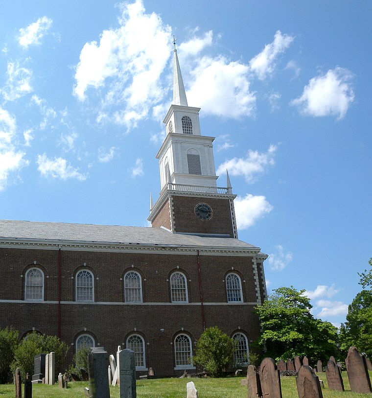
Photo: Jim.henderson, Public domain.
The City of Orange is a township in Essex County, in the U.S. state of New Jersey. As of the 2020 United States census, the township's population was 34,447, an increase of 4,313 from the 2010 census count of 30,134, which in turn reflected a decline of 2,734 from the 32,868 counted in the 2000 census.
East Orange
Town

Photo: Jim.henderson, Public domain.
East Orange is a city in Essex County, in the U.S. state of New Jersey. As of the 2020 United States census, the city's population was 69,612, an increase of 5,342 from the 2010 census count of 64,270, which in turn reflected a decline of 5,554 from the 69,824 counted in the 2000 census.
Jersey Explorer Children’s Museum
- Type: Museum
- Address: 192 Dodd Street, East Orange, NJ 07017
- Categories: building, tourism, and tourist attraction
- Location: City of East Orange, Essex County, Gateway, New Jersey, Mid-Atlantic, United States, North America
- View on OpenStreetMap
Latitude
40.7821° or 40° 46′ 56″ northLongitude
-74.21022° or 74° 12′ 37″ westOpen location code
87G7QQJQ+RWOpenStreetMap ID
way 1059945426OpenStreetMap feature
building=yesOpenStreetMap feature
tourism=museum
This page is based on OpenStreetMap, Wikidata, and Wikimedia Commons.
We’d love your help improving our open data sources. Thank you for contributing.
Satellite Map
Discover Jersey Explorer Children’s Museum from above in high-definition satellite imagery.
Notable Places Nearby
Highlights include Watsessing Splash Park and Central Church of Bloomfield and East Orange.
Nearby Places
Explore places such as Whitney E Houston Academy Elementary School and Whitney E. Houston Academy of Creative and Performing Arts.
Essex County: Must-Visit Destinations
Delve into Newark, Newark Liberty International Airport, Montclair, and Maplewood.
Curious Museums to Discover
Uncover intriguing museums from every corner of the globe.
About Mapcarta. Data © OpenStreetMap contributors and available under the Open Database License". Text is available under the CC BY-SA 4.0 license, except for photos, directions, and the map. Photo: King of Hearts, CC BY-SA 3.0.