Résidence meziane
Résidence meziane is a residential building in Commune de Sidi Bel Abbès, Sidi Bel Abbès District, Sidi Bel Abbès Province which is located on Rue Benaouda Yacine. Résidence meziane is situated nearby to Mosquée, as well as near the government office Agence commercial ADE.| Tap on a place to explore it |
Places in the Area
Nearby places include Sidi Bel Abbès and Sidi Lahcene.
Sidi Bel Abbès
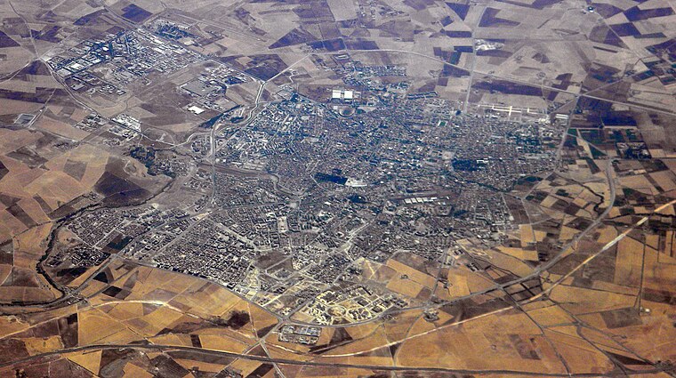
Photo: Wikimedia, CC BY-SA 3.0.
Sidi Bel Abbès, also called Bel Abbès, is the capital of the Sidi Bel Abbès wilaya, Algeria. It is named after Sidi bel Abbass, a Muslim marabout or noble man who is buried there.
Sidi Lahcene
Town

Photo: Yelles, CC BY-SA 3.0.
Sidi Lahcene is a town and commune in Sidi Bel Abbès Province in north-western Algeria. Sidi Lahcene is situated 5 km southwest of Résidence meziane.
Résidence meziane
- Type: Residential building
- Address: Rue Benaouda Yacine, سيدي بلعباس, 22000
- Category: building
- Location: Commune de Sidi Bel Abbès, Sidi Bel Abbès District, Sidi Bel Abbès Province, Algeria, North Africa, Africa
- View on OpenStreetMap
Latitude
35.18718° or 35° 11′ 14″ northLongitude
-0.64836° or 0° 38′ 54″ westOpen location code
8C7X59P2+VMOpenStreetMap ID
way 1069973126OpenStreetMap feature
building=residential
This page is based on OpenStreetMap, Wikidata, and Wikimedia Commons.
We’d love your help improving our open data sources. Thank you for contributing.
Satellite Map
Discover Résidence meziane from above in high-definition satellite imagery.
Notable Places Nearby
Highlights include Mosquée and Agence commercial ADE.
Nearby Places
Explore places such as NADJAOUI MAHFOUD and مواد غدائية عامة (حانوت بوزيان).
Algeria: Must-Visit Destinations
Delve into Algiers, Oran, Constantine, and Annaba.
Curious Residential Buildings to Discover
Uncover intriguing residential buildings from every corner of the globe.
About Mapcarta. Data © OpenStreetMap contributors and available under the Open Database License". Text is available under the CC BY-SA 4.0 license, except for photos, directions, and the map. Photo: Daggett.fr, CC BY-SA 2.0.