Chapman Mill Pond Open Space
Chapman Mill Pond Open Space is a nature reserve in Lower Connecticut River Valley Planning Region, Connecticut. Chapman Mill Pond Open Space is situated nearby to the hamlet Grove Beach, as well as near Kelseytown.| Tap on a place to explore it |
Places of Interest
Highlights include Liberty Green Historic District and Clinton station.
Liberty Green Historic District
Park
Liberty Green Historic District is a local historic district in the town of Clinton, Connecticut, and Liberty Green is a triangular town green within it. The district was created in 1979 following a lengthy study, report and enabling ordinance…
Clinton station
Railway station

Photo: Pi.1415926535, CC BY-SA 4.0.
Clinton station is a regional rail station served by the CT Rail Shore Line East service located near downtown Clinton, Connecticut. The station has two side platforms connected by a footbridge.
Westbrook station
Railway station
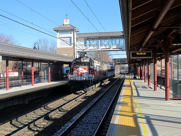
Photo: Pi.1415926535, CC BY-SA 3.0.
Westbrook station is a regional rail station on the Northeast Corridor, located off Connecticut Route 153 just north of the village center of Westbrook, Connecticut.
Places in the Area
Nearby places include Clinton and Westbrook.
Clinton

Photo: Jeff Bellinger, CC BY-SA 3.0.
Clinton is a Connecticut center shoreline town between the Greater New Haven and Connecticut River Valley regions.
Westbrook
Town

Photo: Pi.1415926535, CC BY-SA 3.0.
Westbrook is a town in Middlesex County, Connecticut, United States. The town is part of the Lower Connecticut River Valley Planning Region. The population was 6,769 at the 2020 census.
Chapman Mill Pond Open Space
- Type: Nature reserve
- Category: recreation area
- Location: Lower Connecticut River Valley Planning Region, Connecticut, New England, United States, North America
- View on OpenStreetMap
Latitude
41.299° or 41° 17′ 56″ northLongitude
-72.4948° or 72° 29′ 41″ westOperator
Town of WestbrookOpen location code
87H97GX4+H3OpenStreetMap ID
way 1075624966OpenStreetMap feature
leisure=nature_reserve
This page is based on OpenStreetMap, Wikidata, and Wikimedia Commons.
We’d love your help improving our open data sources. Thank you for contributing.
Satellite Map
Discover Chapman Mill Pond Open Space from above in high-definition satellite imagery.
Localities in the Area
Explore places such as Grove Beach and Kelseytown.
Notable Places Nearby
Highlights include Menunketesuck Wildlife Management Area and Kirtland Landing.
Connecticut: Must-Visit Destinations
Delve into Hartford, New Haven, Bridgeport, and Stamford.
Curious Nature Reserves to Discover
Uncover intriguing nature reserves from every corner of the globe.
About Mapcarta. Data © OpenStreetMap contributors and available under the Open Database License". Text is available under the CC BY-SA 4.0 license, except for photos, directions, and the map. Photo: Wikimedia, CC0.