Infektions- und Isolierstall
Infektions- und Isolierstall is a building in Gießen, Giessen, Hesse which is located on Frankfurter Straße. Infektions- und Isolierstall is situated nearby to the church Neuapostolische Kirche Gießen, as well as near the public building Alte Frauenklinik.| Tap on a place to explore it |
Places of Interest Nearby
Highlights include Gießen station and Mathematikum.
Gießen station
Railway station
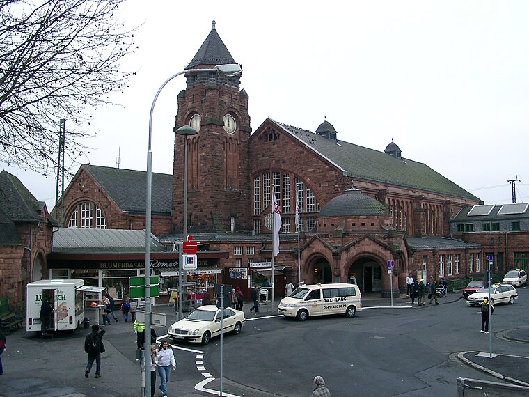
Photo: Randy43, Public domain.
Gießen railway station is the main railway station in Gießen, Hesse, Germany. The station is a Category 2 station is used by 20,000 passengers daily. The station was opened on 25 August 1850 and is located on the Main-Weser Railway and Dill railway. Gießen station is situated 750 metres northeast of Infektions- und Isolierstall.
Mathematikum
Museum

Photo: Sicherlich, CC BY-SA 3.0.
The Mathematikum is a science museum, located in Gießen, Germany, which offers a huge variety of mathematical hands-on exhibits. It was founded by Albrecht Beutelspacher, a German mathematician. Mathematikum is situated 1 km northeast of Infektions- und Isolierstall.
Liebig Museum
Museum

Photo: Longbow4u, CC BY-SA 3.0.
Liebig Museum is situated 1 km northeast of Infektions- und Isolierstall.
Places in the Area
Nearby places include Linden and Annerod.
Linden
Village

Photo: Cherubino, CC BY-SA 3.0.
Linden is a town in the district of Gießen, in Hesse, Germany. It is situated 6 km south of Gießen. The town consists of the two parts Großen-Linden and Leihgestern. The Dießenbach, a small brook, flows into the Kleebach in Linden. Linden is situated 5 km south of Infektions- und Isolierstall.
Annerod
Village

Photo: Cherubino, CC BY-SA 4.0.
Annerod is a small village, part of the municipality Fernwald, in Germany between Gießen and Großen-Buseck approximately 70 km north of Frankfurt. Annerod has a population of about 3189 people. Annerod is situated 7 km east of Infektions- und Isolierstall.
Infektions- und Isolierstall
- Type: Building
- Address: Frankfurter Straße 128, Gießen, 35392
- Location: Gießen, Giessen, North Hesse, Hesse, Germany, Central Europe, Europe
- View on OpenStreetMap
Latitude
50.57382° or 50° 34′ 26″ northLongitude
8.65747° or 8° 39′ 27″ eastOperator
Justus-Liebig-UniversitätOpen location code
9F2CHMF4+GXOpenStreetMap ID
way 1081127176OpenStreetMap feature
building=yes
This page is based on OpenStreetMap, Wikidata, and Wikimedia Commons.
We’d love your help improving our open data sources. Thank you for contributing.
Satellite Map
Discover Infektions- und Isolierstall from above in high-definition satellite imagery.
Notable Places Nearby
Highlights include Neuapostolische Kirche Gießen and Alte Frauenklinik.
Nearby Places
Explore places such as Lagerhaus und Werkstatt and Pferdeoprationsgebäude.
North Hesse: Must-Visit Destinations
Delve into Kassel, Wetzlar, Marburg, and Fulda.
Curious Buildings to Discover
Uncover intriguing buildings from every corner of the globe.
About Mapcarta. Data © OpenStreetMap contributors and available under the Open Database License". Text is available under the CC BY-SA 4.0 license, except for photos, directions, and the map. Photo: Adam63, CC BY-SA 3.0.