Kittholmen
Kittholmen is a parking area in Jakobstad, Ostrobothnia. Kittholmen is situated nearby to the museum Jacobstads Wapen, as well as near the passenger ship terminal Gamla Hamn.| Tap on a place to explore it |
Places of Interest Nearby
Highlights include Jakobstad City Hall and Jakobstad Church.
Jakobstad City Hall
Town hall
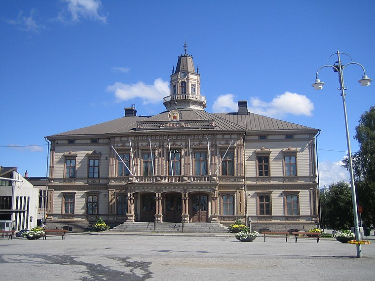
Photo: Tomisti, CC BY-SA 3.0.
Jakobstad City Hall is a historic building in the city of Jakobstad, Finland. It was completed in 1875. The current look of the building dates from 1890. Jakobstad City Hall is situated 1½ km southeast of Kittholmen.
Jakobstad Church
Church
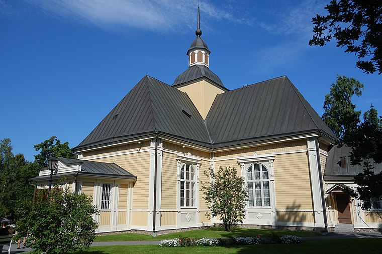
Photo: Asbjørn, CC BY-SA 3.0.
Jakobstad Church is a Lutheran church in the city of Jakobstad, Finland. It was constructed in 1731 by Johan Knubb. The church has been built on the same place, where the first church in Jakobstad was located before it was burned down by Russians in 1714. Jakobstad Church is situated 1¼ km southeast of Kittholmen.
Pietarsaaren Saalem-seurakunta
Church

Photo: Weisself, CC BY-SA 4.0.
Pietarsaaren Saalem-seurakunta is a church, which is situated 1½ km southeast of Kittholmen.
Places in the Area
Nearby places include Larsmo.
Larsmo

Photo: Wikimedia, CC BY-SA 3.0.
Larsmo is a municipality in Finland, located on the west coast of the country. Larsmo is situated in Ostrobothnia, along the Gulf of Bothnia. The population of Larsmo is approximately 6,000, while the sub-region has a population of approximately 51,000.
Kittholmen
- Type: Parking area
- Category: transportation
- Location: Jakobstad, Jakobstadsregionen, Ostrobothnia, West Coast, Finland, Nordic countries, Europe
- View on OpenStreetMap
Latitude
63.68675° or 63° 41′ 12″ northLongitude
22.68848° or 22° 41′ 19″ eastOpen location code
9GM4MMPQ+P9OpenStreetMap ID
way 1085303819OpenStreetMap feature
amenity=parking
This page is based on OpenStreetMap, Wikidata, and Wikimedia Commons.
We’d love your help improving our open data sources. Thank you for contributing.
Satellite Map
Discover Kittholmen from above in high-definition satellite imagery.
In Other Languages
From Finnish to Swedish—“Kittholmen” goes by many names.
- Finnish: “Kittholma”
- Swedish: “Kittholmen”
Places with the Same Name
Discover other places named “Kittholmen”.
Notable Places Nearby
Highlights include Jacobstads Wapen and Kittholmen.
Nearby Places
Explore places such as Skansen - Maj´s glasscafé and Skonaren Vega.
Ostrobothnia: Must-Visit Destinations
Delve into Vaasa, Kristinestad, Kaskinen, and Närpes.
Curious Parking Areas to Discover
Uncover intriguing parking areas from every corner of the globe.
About Mapcarta. Data © OpenStreetMap contributors and available under the Open Database License". Text is available under the CC BY-SA 4.0 license, except for photos, directions, and the map. Photo: Wikimedia, CC0.