D
D is an apartment building in Springfield Township, Union County, New Jersey which is located on Stone Hill Road. D is situated nearby to Briant Park, as well as near Briant Pond.| Tap on a place to explore it |
Places of Interest Nearby
Highlights include Baltusrol Golf Club and Wallace Chapel AME Zion Church.
Baltusrol Golf Club
Golf course
The Baltusrol Golf Club is a private 36-hole golf club in the eastern United States, located in Springfield, New Jersey, about twenty miles west of New York City.
Wallace Chapel AME Zion Church
Church

Photo: Daniel Case, CC BY-SA 3.0.
Wallace Chapel AME Zion Church is located at 138-142 Broad Street at the intersection of Broad and Orchard streets in Summit, Union County, New Jersey, United States. Wallace Chapel AME Zion Church is situated 3,200 feet west of D.
Short Hills station
Railway station
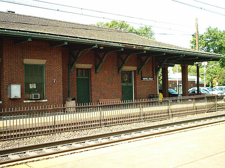
Photo: Temlakos, CC BY-SA 3.0.
Short Hills is a New Jersey Transit train station in Short Hills, New Jersey along the Morris & Essex Lines. Short Hills station is situated 1 mile northeast of D.
Places in the Area
Nearby places include Springfield Township and Summit.
Springfield Township
Town

Photo: Jared Kofsky, CC BY-SA 3.0.
Springfield Township is a township in Union County, in the U.S. state of New Jersey. The township is located on a ridge in northern-central New Jersey, within the Raritan Valley and Rahway Valley regions in the New York metropolitan area.
Summit

Photo: Daniel Case, CC BY-SA 3.0.
Summit is a city in New Jersey. It is located in Union County and is about 20 miles from Manhattan. This article also covers the neighboring town of 1 New Providence.
Millburn
Town

Photo: Jared Kofsky, CC BY-SA 3.0.
Millburn is a suburban township in southwestern Essex County, within the U.S. state of New Jersey, and part of the New York metropolitan area. As of the 2020 United States census, the township's population was 21,710, its highest decennial count ever and… Millburn is situated 1½ miles northeast of D.
D
- Type: Apartment building
- Address: 100 Stone Hill Road, Springfield, NJ 07081
- Categories: building and residential building
- Location: Springfield Township, Union County, Gateway, New Jersey, Mid-Atlantic, United States, North America
- View on OpenStreetMap
Latitude
40.71201° or 40° 42′ 43″ northLongitude
-74.33207° or 74° 19′ 56″ westOpen location code
87G7PM69+R5OpenStreetMap ID
way 1085914180OpenStreetMap feature
building=apartments
This page is based on OpenStreetMap, Wikidata, and Wikimedia Commons.
We’d love your help improving our open data sources. Thank you for contributing.
Satellite Map
Discover D from above in high-definition satellite imagery.
Notable Places Nearby
Highlights include Briant Park and Briant Park Dam.
Nearby Places
Explore places such as Summit Hill Apartments and Troy Hills Condominiums.
Union County: Must-Visit Destinations
Delve into Elizabeth, Summit, Linden, and Rahway.
Curious Apartment Buildings to Discover
Uncover intriguing apartment buildings from every corner of the globe.
About Mapcarta. Data © OpenStreetMap contributors and available under the Open Database License". Text is available under the CC BY-SA 4.0 license, except for photos, directions, and the map. Photo: Wikimedia, CC0.