Village des Fourches
Village des Fourches is a neighborhood in Bormes-les-Mimosas, Arrondissement of Toulon, Provence-Alpes-Côte d’Azur. Village des Fourches is situated nearby to the neighborhood Domaine de Gaou Benat, as well as near the locality Requinquille.| Tap on a place to explore it |
Places of Interest
Highlights include Fort de Brégançon and Phare du cap Bénat.
Fort de Brégançon
Castle
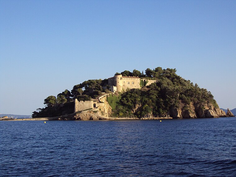
Photo: Patrub01, CC BY-SA 3.0.
The Fort de Brégançon is a medieval fortress that is located 35 metres above sea level on an island off the French Riviera. The island is connected by a short causeway to the mainland in the commune of Bormes-les-Mimosas in the Var department in the Provence-Alpes-Côte d'Azur region. Fort de Brégançon is situated 2½ km southwest of Village des Fourches.


Places in the Area
Nearby places include Le Lavandou.
Le Lavandou

Photo: Vadp, CC BY-SA 4.0.
Le Lavandou is in Var, with its neighbour town of Bormes-les-Mimosas it forms a virtually integral settlement.
Village des Fourches
- Type: Neighborhood
- Category: locality
- Location: Bormes-les-Mimosas, Arrondissement of Toulon, Var, Provence-Alpes-Côte d’Azur, France, Europe
- View on OpenStreetMap
Latitude
43.10348° or 43° 6′ 13″ northLongitude
6.35018° or 6° 21′ 1″ eastOpen location code
8FM84932+93OpenStreetMap ID
way 1086170048OpenStreetMap feature
place=neighbourhood
This page is based on OpenStreetMap, Wikidata, and Wikimedia Commons.
We’d love your help improving our open data sources. Thank you for contributing.
Satellite Map
Discover Village des Fourches from above in high-definition satellite imagery.
Localities in the Area
Explore places such as Village des Fourches and Domaine de Gaou Benat.
Notable Places Nearby
Highlights include Place du Pirate and Place des Tritons.
Var: Must-Visit Destinations
Delve into Toulon, Saint-Tropez, Hyères, and Fréjus.
Curious Neighborhoods to Discover
Uncover intriguing neighborhoods from every corner of the globe.
About Mapcarta. Data © OpenStreetMap contributors and available under the Open Database License". Text is available under the CC BY-SA 4.0 license, except for photos, directions, and the map. Photo: Vadp, CC BY-SA 4.0.